Woods Bay State Natural Area - Member Hike
| Hike Name: | Woods Bay State Natural Area |
|---|---|
| Country: | United States |
| State: | South Carolina |
| Nearby Town: | Olanta |
| Rating: |  |
| Directions: | From Exit 141 on I-95, drive east on SC 53 for 1.3 miles and turn right onto Sumter County S-43-597. When S-43-597 ends, turn left onto Woods Bay Road (S-43-48) and the entrance to the park is 2 miles on the right. |
| Total Hike Distance: | 1.00 miles |
| Hike Difficulty: | Easy |
| Permit Required: | No |
| Hike Type: | Roundtrip, Loop Hike |
| Hike Starts/Ends: | Picnic shelter |
| Trails Used: | Mill pond nature trail, boardwalk |
| Backcountry Campsites: | No |
| Backcountry Water Sources: | Lakes |
| Management: | State Park Service |
| Contact Information: | (843) 659-4445 |
| Best Season: | Winter, Spring, Summer, Fall |
| Users: | Hikers, Dogs |
| Road Conditions: | Primary Paved Roads, Secondary Paved Roads |
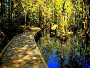
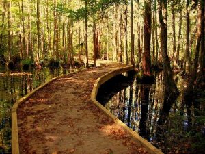
| Hike Summary: | Easy, 0.9 mile hike to the mill pond and back. Start at the picnic shelter and travel to where the trail departs left. When you return from the pond, take a walk on the 500 foot long boardwalk. This is a special treat because you will be walking over the blackwaters of a Carolina Bay, which are natural depressions formed by some mysterious and ancient geologic event. Within the blackwater, are some interesting characters like bowfins and alligators. Dogs are allowed on the boardwalk but must be kept on a short leash, for obvious reasons. Raccoons, river otters, snakes, and various bird species are examples of other wildlife that may be seen. There is also a 1-mile canoe trail available. Canoes can be rented by the hour or by the day. Check with the ranger for prices. |


 Trail Map For This Area
There are no comments yet.