Oakridge Trail, Congaree National Park - Member Hike
| Hike Name: | Oakridge Trail, Congaree National Park |
|---|---|
| Country: | United States |
| State: | South Carolina |
| Nearby Town: | Hopkins |
| Rating: |  |
| Directions: | From Interstate 77, Exit 5: At Exit 5 turn off onto SC Hwy 48 East (Bluff Road), and travel southeast approximately fourteen miles toward Gadsden and turn right onto Mt. View Road. Follow Mt. View Road for 0.8 miles and then turn right onto Old Bluff Road and travel 0.6 miles. Turn left at the park entrance sign and proceed one mile to the Harry Hampton Visitor Center. |
| Total Hike Distance: | 6.60 miles |
| Hike Difficulty: | Easy to Moderate |
| Permit Required: | No |
| Hike Type: | Roundtrip, Loop Hike |
| Hike Starts/Ends: | Harry Hampton Visitors Center |
| Trails Used: | Low Boardwalk, Weston Loop Trail, Oakridge Trail, Elevated Boardwalk |
| Backcountry Campsites: | Yes |
| Backcountry Water Sources: | Streams, Rivers |
| Management: | National Park Service |
| Contact Information: | Visit http://www.nps.gov/cosw/index.htm (803) 776-4396 ext. 0 |
| Best Season: | Winter, Spring, Fall |
| Users: | Hikers |
| Road Conditions: | Primary Paved Roads, Secondary Paved Roads |
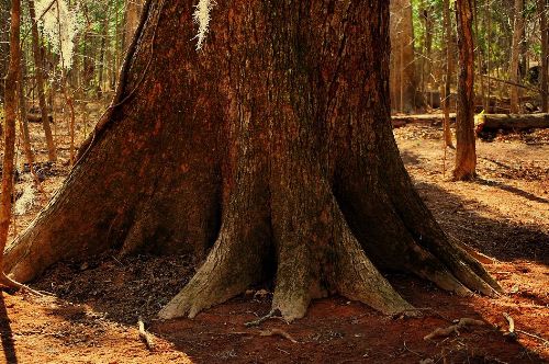
| Hike Summary: | 6.6 miles of interesting walking through old-growth forest and over many streams. Visit http://www.nps.gov/cosw/index.htm for details. Call the park directly for current trail conditions before you visit. Every once in a while, the Congaree River floods it's banks, making a hike on most of the Oakridge Trail impossible. (803) 776-4396 ext. 0 Pick up a free park trail guide at the visitor center before you start walking. There are many combinations of trails that can be enjoyed. The Oakridge Trail is a 'true' loop trail, but using those combinations can give you a more diversified outing. Be sure to ask the rangers about the Friends of Congaree Swamp. This is a non-profit organization that helps protect and promote Congaree National Park and it's unique environment. More info here: http://www.friendsofcongaree.org |


 Trail Map For This Area
There are no comments yet.