Jones Gap Trail - Member Hike
| Hike Name: | Jones Gap Trail |
|---|---|
| Country: | United States |
| State: | South Carolina |
| Nearby Town: | Cleveland |
| Rating: |  |
| Directions: | From Hwy. 11, turn right onto River Falls Road, which changes to Jones Gap Road, and continue to Jones Gap State Park. |
| Total Hike Distance: | 5.30 miles |
| Hike Difficulty: | Moderate |
| Permit Required: | No |
| Hike Type: | One-Way, Shuttle Hike |
| Hike Starts: | Jones Gap |
| Hike Ends: | Hwy. 276 |
| Trails Used: | Jones Gap |
| Backcountry Campsites: | Yes |
| Backcountry Water Sources: | Streams, Rivers |
| Management: | State Park Service |
| Contact Information: | Unknown |
| Best Season: | Spring, Summer, Fall |
| Users: | Hikers |
| Road Conditions: | Primary Paved Roads |
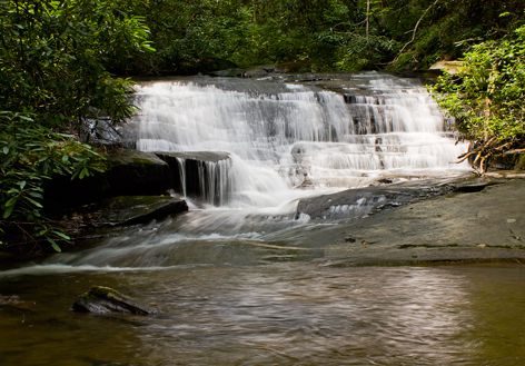
| Hike Summary: | Jones Gap Trail follows an old toll road developed by Solomon Jones in 1840. The trail follows the Middle Saluda River for the majority of it's distance, including many cascades and waterfalls. |

 Trail Map For This Area

There are no comments yet.