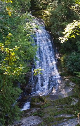
Jocassee Gorges on the Foothills Trail - Member Hike
| Hike Name: | Jocassee Gorges on the Foothills Trail |
|---|---|
| Country: | United States |
| State: | South Carolina |
| Nearby Town: | sunset |
| Rating: |  |
| Directions: | From Bad Creek parking off of Hwy. 130, 10 miles north of Hwy. 11. The other end of this hike is off of Hwy. 178 on Horsepasture Rd. |
| Total Hike Distance: | 27.50 miles |
| Hike Difficulty: | Difficult |
| Permit Required: | No |
| Hike Type: | One-Way, Shuttle Hike |
| Hike Starts: | Bad Creek |
| Hike Ends: | Laurel Valley |
| Trails Used: | Bad Creek Spur, Foothills Trail |
| Backcountry Campsites: | Yes |
| Backcountry Water Sources: | Streams, Rivers, Lakes, Springs |
| Management: | National Park Service |
| Contact Information: | Unknown |
| Best Season: | Spring, Summer, Fall |
| Users: | Hikers |
| Road Conditions: | Maintained Gravel or Dirt Roads, Unmaintained Gravel or Dirt Roads, Four Wheel Drive Required, High Clearance Vehicle Recommended |
| Hike Summary: | http://schikingtrails.blogspot.com/2011/09/jocassee-gorges-on-foothills-trail.html |

 Trail Map For This Area
There are no comments yet.