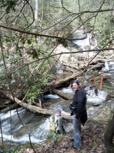
Hidden Falls - Member Hike
| Hike Name: | Hidden Falls |
|---|---|
| Country: | United States |
| State: | South Carolina |
| Nearby Town: | Walhalla |
| Rating: |  |
| Directions: | From Walhalla, drive north on SC28 for approx 8.4 miles and go right on SC 107 for apprx 3 miles to Oconee State Park. Enter the park and follow the signs to the Foothills Trail. After passing the road to cabins 14 - 20, look for a parking area on the right (just prior to the sign for cabins 7 - 13). The Trailhead is on the left just before the parking area. |
| Total Hike Distance: | 5.00 miles |
| Hike Difficulty: | Easy to Moderate |
| Permit Required: | No |
| Hike Type: | In & Out, Backtrack Hike |
| Hike Starts/Ends: | Foothills and Hidden Falls Trailhead |
| Trails Used: | Foothills Trail and Hidden Falls Trail |
| Backcountry Campsites: | No |
| Backcountry Water Sources: | Streams |
| Management: | State Park Service |
| Contact Information: | Oconee State park, 624 State Park Rd, Mountain Rest, SC 29664, 864-638-5353 |
| Best Season: | Spring, Summer, Fall |
| Users: | Hikers |
| Road Conditions: | Primary Paved Roads, Secondary Paved Roads |
| Hike Summary: | Hike starts at Foothills Trail, Hidden Falls, and Tamassee Knob Trailhead. This hike is well signed. Follow the signs. After approx 1.4 miles, you will descend some steps at Old Horse Bond Road. The Foothills Trail goes to the left, the Hidden Falls goes to the right. In approx 350 feet, the trail drops off the road to the left and goes for approx 1.1 miles to the falls. |


 Trail Map For This Area
There are no comments yet.