Foothills Trail - Member Hike
| Hike Name: | Foothills Trail |
|---|---|
| Country: | United States |
| State: | South Carolina |
| Nearby Town: | wahulla |
| Rating: |  |
| Directions: | Look up Oconne SP or Table Rock SP in SC |
| Total Hike Distance: | 80.00 miles |
| Hike Difficulty: | Easy to Moderate |
| Permit Required: | No |
| Hike Type: | One-Way, Shuttle Hike |
| Hike Starts: | Table Rock State Park, SC |
| Hike Ends: | Oconee State Park, SC |
| Trails Used: | Foothills Trail |
| Backcountry Campsites: | Yes |
| Backcountry Water Sources: | Streams, Rivers |
| Management: | State Park Service |
| Contact Information: | Foothills Trail Conference PO Box 3041 Greenville, SC 29602 864-467-9537 |
| Best Season: | Spring, Fall |
| Users: | Hikers |
| Road Conditions: | Primary Paved Roads, Maintained Gravel or Dirt Roads |
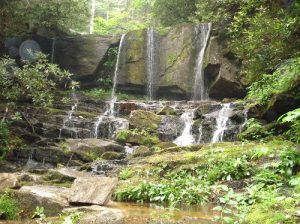
| Hike Summary: | This is a wonderful short distance hiking trail. Plenty of campsites and water. Views are probably better in the winter when the foliage is off the trees. The first half from Table Rock SP is maintained by the Duke Power Company and they have built numerous bridges and staircases. There are a number of waterfalls along the way. The best being Whitewater Falls. You need to divert from the trail for about 1/8 mile to get to the water fall lookout point but it is worth it. If the weather is warm enough, as it was when I hiked, you can get in a swim in the Chattooga River. The trail intersects with the Bartram Trail as it crosses into Georgia. For detailed journal see: www.trailjournals.com/hammockhangerFHT06/ |


 Trail Map For This Area

There are no comments yet.