Ellicott Rock Wilderness - Member Hike
| Hike Name: | Ellicott Rock Wilderness |
|---|---|
| Country: | United States |
| State: | South Carolina |
| Nearby Town: | Walhalla, SC |
| Rating: |  |
| Directions: | SC 107 to Burrell Ford Road |
| Total Hike Distance: | 7.50 miles |
| Hike Difficulty: | Easy to Moderate |
| Permit Required: | No |
| Hike Type: | In & Out, Backtrack Hike |
| Hike Starts/Ends: | Burrell's Ford Campground |
| Trails Used: | Chattooga River Trail |
| Backcountry Campsites: | Yes |
| Backcountry Water Sources: | Rivers |
| Management: | U.S. Forest Service |
| Contact Information: | Andrew Pickens Ranger District 112 Andrew Pickens Circle Mountain Rest, South Carolina 29664 Phone: (864) 638-9568 Fax: (864) 638-2659 Hours: Monday—Friday, 8 a.m.—4:30 p.m. |
| Best Season: | Winter, Spring, Fall |
| Users: | Hikers, Dogs |
| Road Conditions: | Secondary Paved Roads |
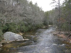
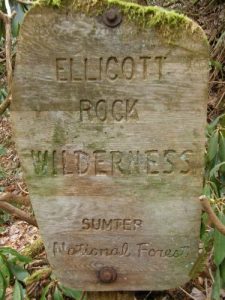
| Hike Summary: | I Parked at Burrell's Ford Campground (N34 58.485 W83 06.884). My destination was Ellicott's Rock and the Tri-corner of South Carolina, North Carolina and Georgia boarders via the Chattooga River Trail. www.nationalregister.sc.gov/oconee/S10817737004/index.htm From Burrell's Ford Campground the hike to Ellicott's Rock was just over 3 1/2 miles one way. The trail was well maintained and followed the Chattooga River. There where other trails that intersected the Chattooga River Trail. They can be seen on this map. www.sherpaguides.com/georgia/mountains/blue_ridge/eastern/map_ellicott_rock_wilderness.html |
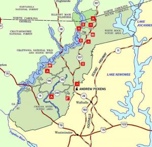

 Trail Map For This Area
There are no comments yet.