Devil's Fork State Park - Oconee Bell Nature Trail - Member Hike
| Hike Name: | Devil's Fork State Park - Oconee Bell Nature Trail |
|---|---|
| Country: | United States |
| State: | South Carolina |
| Nearby Town: | Salem |
| Rating: |  |
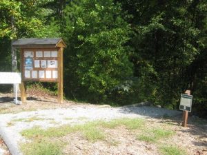
| Directions: | Driving Directions: From I-85 at the GA line: Take exit 1 to Hwy 11 for approx. 40 miles, turn left on Jocassee Lake Rd, and travel 3 mi. From I-85 at the NC line: Travel south to Hwy 11 exit at Gaffney and proceed on Hwy 11 for approx. 90 miles, turn right on Jocassee Lk. Rd and travel 3 miles. From I-26: Take exit 5 onto Hwy 11 to Campobello. Travel for approximately 60 mi. Turn rt. on Lake Jocassee Rd., and travel 3 mi. From Walhalla, drive north on SC 11 for approximately 13.5 miles, and turn left onto Jocassee Rd. (Oconee County S-37-25). Continue driving 4 miles on this winding road and bear right at the sign that clearly points to the park office. The trailhead is behind the park office at the bottom of the hill. You can park in the boat ramp parking lot behind the park office. |
| Total Hike Distance: | 1.00 miles |
| Hike Difficulty: | No Answer |
| Permit Required: | No |
| Hike Type: | Roundtrip, Loop Hike |
| Hike Starts/Ends: | Visitor's Center |
| Trails Used: | Oconee Bell Nature Trail |
| Backcountry Campsites: | No |
| Backcountry Water Sources: | Streams |
| Management: | State Park Service |
| Contact Information: | Devils Fork State Park 161 Holcombe Circle Salem, SC, 29676 Telephone: 864-944-2639. |
| Best Season: | Winter, Spring, Summer, Fall |
| Users: | Hikers, Dogs |
| Road Conditions: | Primary Paved Roads, Secondary Paved Roads |
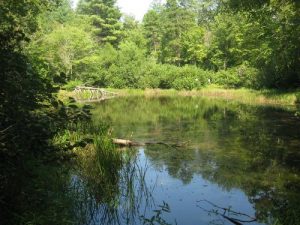
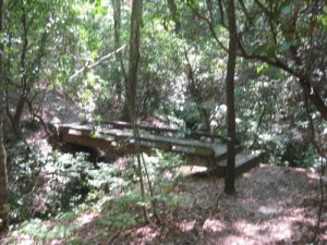
| Hike Summary: | Devil's Fork State Park is located in the northwestern corner of South Carolina and is an undeveloped 7,500-acre reservoir tucked deep into the Blue Ridge Mountains. It was leased in 1991 by the State of South Carolina from the Duke Power Company and it currently provides the only public access to Lake Jocassee. This short and easy hike in Devils Fork State Park gets its name from a rare wild flower, the Oconee Bell, that has attractive white blooms. The trail begins just down from the visitor's center at the back of the boat parking area and loops through a hardwood forest that has numerous oaks and hickory trees towering above in the canopy. The trail is well maintained and has interpretive signs and benches as it crisscrosses a small creek on the lower sections of the trail. As you start your climb back to the ridgeline, you will pass a small pond on the right about halfway along the path. The trail is heavily wooded in the summer months, and the pond may come as a surprise, albeit a brief one, before you make the final ascent back to the parking area. |
Recommended
Trip Reports
There are no Trip Reports yet.


 Trail Map For This Area
There are no comments yet.