Chattooga River Trail - Member Hike
| Hike Name: | Chattooga River Trail |
|---|---|
| Country: | United States |
| State: | South Carolina |
| Nearby Town: | Walhalla, SC |
| Rating: |  |
| Directions: | From Walhalla, take SC-28 West toward Georgia for a few miles (about 8) until SC-107 splits from it and take SC-107 N. Pass the State Park (at 3 miles) and continue for another 10 or 12 miles to Fish Hatchery Road on left. Take a left on Fish Hatchery Road and go down the hill about 200 yds and there is a parking area on the left at the trailhead. |
| Total Hike Distance: | 38.40 miles |
| Hike Difficulty: | Moderate |
| Permit Required: | No |
| Hike Type: | One-Way, Shuttle Hike |
| Hike Starts: | Foothills Trail intersection with Fish Hatchery Road |
| Hike Ends: | US-76 crossing of Chatooga River |
| Trails Used: | Foothills Trail, Chatooga River Trail, Bartram Trail |
| Backcountry Campsites: | No |
| Backcountry Water Sources: | Streams, Rivers |
| Management: | U.S. Forest Service |
| Contact Information: | Chatahoochee National Forest, GA: http://www.fs.fed.us/conf/rec/bartram_trail.pdf Sumter National Forest, SC (Andrew Pickens District): Andrew Pickens 112 Andrew Pickens Circle Mountain Rest, South Carolina 29664 864-638-9568 http://www.fs.fed.us/r8/fms/forest/recreation/waterfalls.html Birdshooter's tale: https://n2backpacking.com/long_trails/crt/crt_main.htm Bartram Trail Conference: http://www.bartramtrail.org |
| Best Season: | Spring, Summer, Fall |
| Users: | Hikers, Dogs |
| Road Conditions: | Primary Paved Roads, Secondary Paved Roads, Maintained Gravel or Dirt Roads |
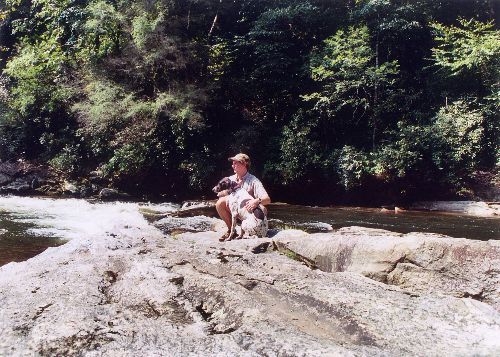
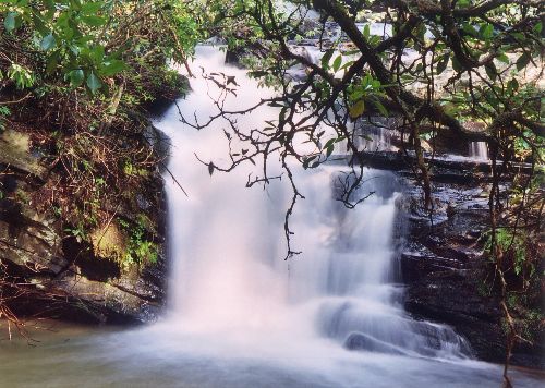
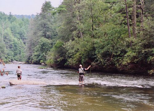
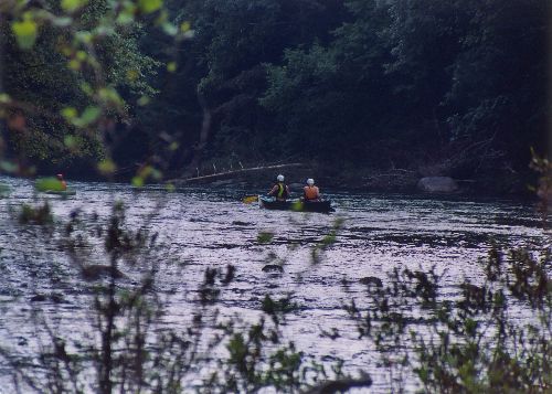
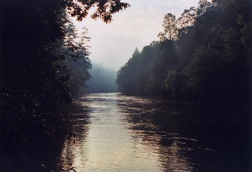
| Hike Summary: | I arrived at the trailhead about 10pm and hiked in 1/4 mile to find a place for the tent right at the crest of a rise. Sadie and I started around 8 the next morning after breaking camp and made good time. Where the Foothills trail closes in on the river and merges with the Chatooga River Trail (CRT), it got a bit confusing as this was prime car camping area and there were a bunch of crossing trails around. Strangely the area was empty, especially for a Labor Day weekend. We continued downstream and passed Spoonauger Falls and Burrell's Ford Campground. We crossed over Kings Creek then headed up the creek to the falls - worth the extra walk! Note that the thick foilage made photography a bit tricky if not impossible in places. Near Big Bend, I heard and then saw a black bear below us near the river. I also saw a couple of Osprey over the length of the hike. A little after 3 we came upon a group of people wading in the cool water of Pigpen falls. After 13.3 miles, Sadie and I decide this is a nice place to make camp. It was a good choice as we had dinner with a nice man and his son who were also camping there and we stayed up till dark talking camp. +2439ft, -3558ft for the day. The next morning we woke up and were off by 8:20 as I knew we had a long way to go. Once we crossed over to Georgia via the Hwy 28 bridge, the CRT follows the Bartram Trail for a while. It is quite interesting to see the change in fauna from one side of the river to the other. Lots of Magnolia/hardwood and such on the SC side and a bit piney on the Georgia side. The CRT (grey blazes) splits from the Bartram Trail (yellow blazes) near Dicks Creek Road and you need to be sure to stay left. I didn't and added a few miles to the hike, but no big deal. After a bit of rough orienteering and trailblazing (on all 4's), we got back to the CRT at Lick Log Creek just in time to see the last canoes of the day around 5pm. After 16.7 miles - time to call it a day! +2254ft, -2724ft for the day. The next morning, we woke and hit the trail around 8:10 to start the 6.25 mile hike to US Hwy 76. This was pretty easy and we reached the bridge about 12:30. The reason I was booking it was that I knew we had to hitch back, so I wanted plenty of time to do that. Good thing - it took 4 rides back and just under 3 hours to get back to the Hatchery Road. One nice fellah even donated a cold Heineken to the cause. Very welcome, indeed! +1195ft, -1273ft for the day This was a nice hike and I ran into maybe 10 people with backpacks on the entire time. None of those were going in more than a couple of miles to camp. This was VERY surprising given the beautiful weather and a holiday weekend. Weather was highs in the lower 80s and lows in the lower 60s - no clouds until the final day and they were few. Although you can hear the river often, it is often out of sight as a result of the cover (I never used the sunglasses I brought). I would hike the upper portion (above Hwy 28) again in a heartbeat, but the lower half didn't do that much for me for some reason. It was pretty, but I'd rather do the top half and fish/lounge more along the river or numerous creeks. Sadie had a good time too and I think she'll take any hike she can get. Thanks to Birdshooter for the tpo file and maps! I met a couple of Bartram trail keepers and they told me that the Forest Service sells a detailed map booklet that includes the Bartram, Foothills, and Chatooga River Trails. I think that might be a worthwhile investment. |
Recommended

 Trail Map For This Area
Trip Reports
There are no Trip Reports yet.
There are no comments yet.