Chatooga River Trail - Member Hike
| Hike Name: | Chatooga River Trail |
|---|---|
| Country: | United States |
| State: | South Carolina |
| Nearby Town: | Walhalla |
| Rating: |  |
| Directions: | From Walhalla travel north 9.5 miles on SC 28. then take SC 107 northeast for 10.3 miles. Burrell's Ford camp ground is on Forest Road 708 on the left. This road isn't well marked, so be on the look out. |
| Total Hike Distance: | 6.00 miles |
| Hike Difficulty: | Easy to Moderate |
| Permit Required: | No |
| Hike Type: | One-Way, Shuttle Hike |
| Hike Starts: | Burrell's Ford Camp Ground |
| Hike Ends: | Burrell's Ford |
| Trails Used: | Kings Creek Falls Trl. Foot Hills Trl. |
| Backcountry Campsites: | Yes |
| Backcountry Water Sources: | Streams, Rivers, Springs |
| Management: | State Park Service |
| Contact Information: | Unknown |
| Best Season: | Spring, Summer, Fall |
| Users: | Hikers, Dogs |
| Road Conditions: | Primary Paved Roads, Secondary Paved Roads, Maintained Gravel or Dirt Roads |
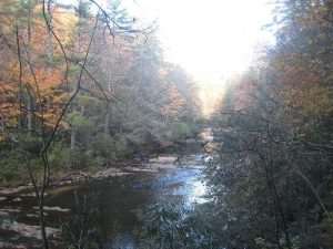
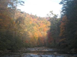
| Hike Summary: | This isn't a desscription of the full trail. I started hiking after setting up camp at Burrell's Ford. The trail starts to the south of the campground and continues to the north of it. I am not sure of the exact numbers for the trail. From the camp ground we hiked down Big Bend Falls. The river was in its low season, so the falls wasn't that great, but the leaves were changing. The mountain sides were full of color and really breath-taking. Spoonauger falls is near the campground as well. |
Recommended
Trip Reports
There are no Trip Reports yet.


 Trail Map For This Area
There are no comments yet.