Forbes State Forest - Mount Davis - Member Hike
| Hike Name: | Forbes State Forest - Mount Davis |
|---|---|
| Country: | United States |
| State: | Pennsylvania |
| Nearby Town: | Confluence |
| Rating: |  |
| Directions: | From Confluence, take Listonburg Road (PA-523) south out of town, and turn left on Mount Davis Road. Travel approximately 10.7 miles on Mount Davis Road, and then turn right on South Wolf Rock Road. Travel approximately another 1/2 mile and turn left on the unamed road that leads to the parking area. |
| Total Hike Distance: | 0.10 miles |
| Hike Difficulty: | Easy |
| Permit Required: | No |
| Hike Type: | In & Out, Backtrack Hike |
| Hike Starts/Ends: | Parking Area |
| Trails Used: | Shelter Rock and High Point Trails |
| Backcountry Campsites: | No |
| Backcountry Water Sources: | None |
| Management: | State Forest Service |
| Contact Information: | Pennsylvania Department of Conservation and Natural Resources Bureau of Forestry - Forbes Forest District 1291 Route 30 PO Box 519 Laughlintown, PA 15655-0519 Phone: 724-238-1200 Fax: 724-238-5000 Email: FD04@state.pa.us www.dcnr.state.pa.us/forestry/stateforests/forbes/index.htm |
| Best Season: | Winter, Spring, Summer, Fall |
| Users: | Hikers, Dogs |
| Road Conditions: | Primary Paved Roads |
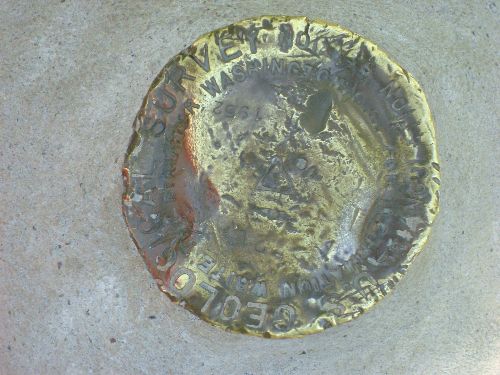
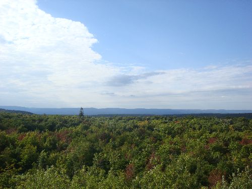
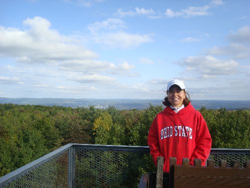
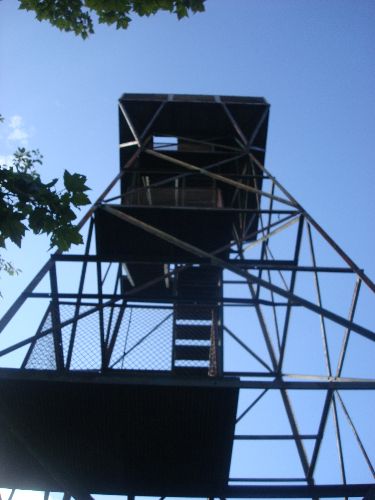
| Hike Summary: | 3,213-foot Mount Davis, the highest point in Pennsylvania, is found in the Negro Mountain tract of Forbes State Forest, which spreads across the high ridges of the Laurel Highlands. A tower stands on the top of the peak, and on clear days you can see parts of Maryland, the town of Salisbury, Pennsylvania, and a series of large windmills off in the distance. The tower, as well as the high point, which actually sits atop a large boulder adjacent to the tower, can be reached by a short jaunt, probably less than a tenth of a mile, on the trail from the parking area. |


One reply on “Forbes State Forest - Mount Davis - Member Hike”
Hard to believe that the highest point in PA is only 3200 feet. There mountains seem so much bigger than that.