Wahkeena Falls Loop Trail - Member Hike
| Hike Name: | Wahkeena Falls Loop Trail |
|---|---|
| Country: | United States |
| State: | Oregon |
| Nearby Town: | Portland, OR |
| Rating: |  |
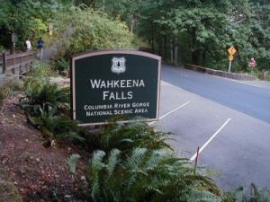
| Directions: | From Portland, drive east on I-84 to Exit 28 (Bridal Veil). Drive east on the Historic Highway 2.4 miles to the Wahkeena Trailhead and Campground. From the east, take exit 35 (Ainsworth Park). Drive 5.6 miles west on the Historic Highway to the same lot. The campground and restrooms are only open in the summer, but the trailhead lot is always open. |
| Total Hike Distance: | 4.10 miles |
| Hike Difficulty: | Moderate |
| Permit Required: | No |
| Hike Type: | One-Way, Shuttle Hike |
| Hike Starts: | Trail Head |
| Hike Ends: | Trail Head / Loop |
| Trails Used: | Wahkeena Falls Loop |
| Backcountry Campsites: | No |
| Backcountry Water Sources: | Streams, Rivers, Springs |
| Management: | State Forest Service |
| Contact Information: | Wahkeena Falls Loop, OR |
| Best Season: | Spring, Summer, Fall |
| Users: | Hikers, Dogs |
| Road Conditions: | Primary Paved Roads, Secondary Paved Roads |
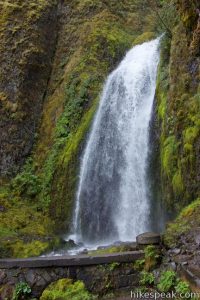
| Hike Summary: | This is a beautiful loop in the gorge that brings you to one of the best waterfalls in the area. This loop hike passes by several waterfalls. The trail ascends Wahkeena Creek past the springs which feed the waterfall and then continues onto Larch Mountain Trail which brings you to Multnomah Falls. Looking down from the top of the tallest waterfall in Oregon is pretty amazing! The trail then descends down to the Multnomah Lodge and returns via a the highway to the Wahkeena parking lot. This trail is popular but it isn't overly crowded either, so if you are looking to get away from lots of people and hustle and bustle but don't mind saying hello to the random hiker, this hike will be perfect for you. |


There are no comments yet.