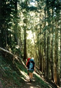
Mt. Hood National Forest - Mount Hood - Member Hike
| Hike Name: | Mt. Hood National Forest - Mount Hood |
|---|---|
| Country: | United States |
| State: | Oregon |
| Nearby Town: | Rhododendron |
| Rating: |  |
| Directions: | From the Portland Airport; Airport Way to I-205 South 205 South to I-84 East (The Dalles exit) I-84 East to exit 16 "Wood Village" Right at stop sign on to 242nd Follow 242nd to Burnside (approx. 3 mi.) Left on Burnside (U-Haul rentals on the corner) Burnside turns in to Hwy 26 East at the Newport Bay restaurant Follow Hwy 26 East to the Timberline Road turn-off (about 40 mi.), you will pass through the towns of Sandy, Welches, and Rhododendron. Turn left on the Timberline access road; follow the road to Timberline (6 mi.) |
| Total Hike Distance: | 11.00 miles |
| Hike Difficulty: | Easy to Moderate |
| Permit Required: | No |
| Hike Type: | In & Out, Backtrack Hike |
| Hike Starts/Ends: | Timberline Lodge |
| Trails Used: | Pacific Crest Trail |
| Backcountry Campsites: | Yes |
| Backcountry Water Sources: | Streams |
| Management: | U.S. Forest Service |
| Contact Information: | Mt. Hood National Forest 16400 Champion Way Sandy, OR 97055 (503) 668-1700 |
| Best Season: | Summer, Fall |
| Users: | Hikers, Dogs, Horses |
| Road Conditions: | Primary Paved Roads, Secondary Paved Roads |
| Hike Summary: | The Pacific Crest Trail (PCT) cuts through the Mt. Hood National Forest and it shares a name with the Timberline Trail #600 near Timberline Lodge. We hiked this trail and camped near the base of Mount Hood next to the PCT. It's a fairly easy hike out and back and makes for a good day or overnight hike. Many long distance hikers highly recommend this section of the PCT which extends up to Snowqualmie Pass in Washington. |


There are no comments yet.