Benham Falls - Member Hike
| Hike Name: | Benham Falls |
|---|---|
| Country: | United States |
| State: | Oregon |
| Nearby Town: | Sunriver/ Bend |
| Rating: |  |
| Directions: | From Bend, OR: Travel south on Highway 97 for approximately 8 miles and take the Lava Lands Visitor Center exit to the right. Continue passed Lava Lands Visitor Center on Forest Road 9702 for approximately 4 miles. |
| Total Hike Distance: | 1.50 miles |
| Hike Difficulty: | Easy |
| Permit Required: | No |
| Hike Type: | In & Out, Backtrack Hike |
| Hike Starts/Ends: | Trail Head |
| Trails Used: | Out and back trail |
| Backcountry Campsites: | No |
| Backcountry Water Sources: | Rivers |
| Management: | State Forest Service |
| Contact Information: | Benham Falls |
| Best Season: | Spring, Summer, Fall |
| Users: | Hikers, Bikers, Dogs, Horses |
| Road Conditions: | Secondary Paved Roads, Maintained Gravel or Dirt Roads, Unmaintained Gravel or Dirt Roads |
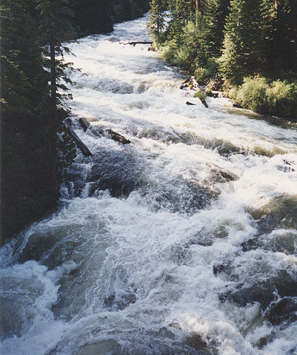
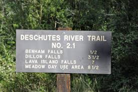
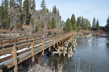
| Hike Summary: | If I could give 10 stars I would. This hike and place is one of my favorites to go to. I can't even count how many times I have come out here. Living and growing up in Sunriver this waterfall and hike is on the back way to Bend. Like I said there are 2 ways to get there but this is my favorite way to go. You park and hike down to the waterfall on a very well marked trail. Then you can head back up the way you came and do the rest of the hike that has great views and the river until you reach the bridge at the end of the trail. Then just turn around and you can hit the waterfall all over again! I mean what can be better than that. While this is a popular hike for people with dogs or bikes you can still manage to get the place to yourself sometimes. So do not over look this hike!!! It is so peaceful and tons of locals love calling this area home. |


There are no comments yet.