Standing Indian - Member Hike
| Hike Name: | Standing Indian |
|---|---|
| Country: | United States |
| State: | North Carolina |
| Nearby Town: | Franklin |
| Rating: |  |
| Directions: | (Deep Gap) - From Franklin, go West on US 64 for 13.6 miles (from overpass where US23 turns South toward Atlanta) to FS71. Turn is just past top of hill with 'Clay County' sign. From West, follow US64 East past Hayesville, NC, make long climb up mountain, and near top of second climb, watch for sign for FS71 on right. FS71 is a 6-mile single-lane gravel road, normally quite passable for autos. Note that this road is closed during the Winter -- usually between Jan. 1st and March 15th. Follow FS71 to parking area at end; the AT crosses through this parking area. To go South on AT, head West out of parking area -- to go North, head East. (Standing Indian Campground) - From Franklin, follow US64 West 11.4 miles (from overpass where US23 goes South to Atlanta) to left turn at sign saying "Appalachian Trail" and "Standing Indian Campground". Follow this road (Old Rt. 64) 1.9 miles to sign reading "Standing Indian Campground" and turn right on paved road (FS67). Follow this road to Standing Indian Campground. |
| Total Hike Distance: | 6.60 miles |
| Hike Difficulty: | Moderate to Difficult |
| Permit Required: | No |
| Hike Type: | One-Way, Shuttle Hike |
| Hike Starts: | USFS 71 (Deep Gap) |
| Hike Ends: | Standing Indian Campground |
| Trails Used: | Appalachian, Lower Ridge Trails |
| Backcountry Campsites: | Yes |
| Backcountry Water Sources: | Streams, Springs |
| Management: | U.S. Forest Service |
| Contact Information: | Forest/Park/Wilderness: Nantahala National Forest Management: National Forest Service Park Address/Phone Number: P.O. Box 2750, Asheville, NC 28802 Wayah Ranger District – (704) 524-6441 |
| Best Season: | Spring, Summer, Fall |
| Users: | Hikers, Dogs |
| Road Conditions: | Primary Paved Roads, Secondary Paved Roads, Maintained Gravel or Dirt Roads |
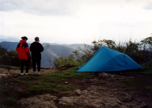
| Hike Summary: | Standing Indian Mountain at 5,498 feet is the highest point on the Appalachian Trail south of the Great Smoky Mountains. The summit has excellent views to both the west and south, and the Standing Indian Shelter is located nearby for overnight accommodations. The Nantahala River is born on Standing Indian Mountain, just a short distance from here. |


Recommended

 Trail Map For This Area
Trip Reports
There are no Trip Reports yet.
There are no comments yet.