Siler Bald - Member Hike
| Hike Name: | Siler Bald |
|---|---|
| Country: | United States |
| State: | North Carolina |
| Nearby Town: | Franklin |
| Rating: |  |
| Directions: | From Franklin follow SR 1310 for 9.2miles (or about twenty minutes) to a parking area for the AT on the left. |
| Total Hike Distance: | 2.30 miles |
| Hike Difficulty: | Moderate to Difficult |
| Permit Required: | No |
| Hike Type: | One-Way, Shuttle Hike |
| Hike Starts: | Parking area on sr 1310 |
| Hike Ends: | Siler Bald 5,219 ft. |
| Trails Used: | Appalachian Trail |
| Backcountry Campsites: | Yes |
| Backcountry Water Sources: | None |
| Management: | U.S. Forest Service |
| Contact Information: | Unknown |
| Best Season: | Spring, Summer, Fall |
| Users: | Hikers, Dogs |
| Road Conditions: | Primary Paved Roads, Secondary Paved Roads |
| Hike Summary: | The hike begins at the parking lot just off of 1310. The elevation gain for this hike is right at 1,100 feet. With the exception of the last 300 feet, the grade is very managable. The trail follows a wooded route, with the last ascent to the top of Siler Bald being in the clear. Durig the winter season this results in a pretty extreme temperature change because of the wind. The trail is cleary blazed with a white stamp. Once you reach the clearing, which is used as a lower camp site, the trail bends to your right with a steep final climb to the top of the Bald. It would be impossible to miss. Straight ahead across the clearing is a sign that will direct you to the Siler Bald AT shelter. It was reported on other reviews that there was a water spicket here, but after much time spent searching, we found no spicket. It is possible to camp on top of the bald if weather permits. The views are amazing. You can catch a little glimpse of Aquone Lake to the East and Wayah Bald (marked by radio towers) to the North. |
Recommended
Trip Reports
There are no Trip Reports yet.


 Trail Map For This Area
One reply on “Siler Bald - Member Hike”
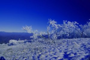
Your first picture … the blue one….amazing. That is calendar material. Seriously. Fantastic photo.