Pisgah Nat'l Forest - Harpers Creek - Member Hike
| Hike Name: | Pisgah Nat'l Forest - Harpers Creek |
|---|---|
| Country: | United States |
| State: | North Carolina |
| Nearby Town: | Mortimer |
| Rating: |  |
| Directions: | Follow US-181 North from I-40. Turn right onto State Route 1328/FS 982 and park at the Wilson Creek Visitor Center on left (approx. 5 mi.) |
| Total Hike Distance: | 19.00 miles |
| Hike Difficulty: | Moderate |
| Permit Required: | No |
| Hike Type: | Roundtrip, Loop Hike |
| Hike Starts/Ends: | Wilson Creek Visitor Center |
| Trails Used: | Harper Creek Trail, North Harper Creek Trail, South Raider Camp Trail |
| Backcountry Campsites: | Yes |
| Backcountry Water Sources: | Streams |
| Management: | U.S. Forest Service |
| Contact Information: | Wilson Creek Visitor Center 7805 Brown Mountain Beach Rd. Collettsville, NC 28611 Phone: (828) 759-0005 http://www.explorecaldwell.com/visitorcenter.html |
| Best Season: | Spring, Summer, Fall |
| Users: | Hikers, Dogs |
| Road Conditions: | Secondary Paved Roads, Maintained Gravel or Dirt Roads, Unmaintained Gravel or Dirt Roads |
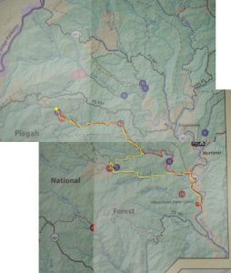
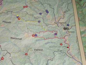
| Hike Summary: | Arrive to Wilson Creek Visitor Center via SR-1382 off of US181 North. Follow SR13-82 North to beginning of Harper Creek Trail (on left). Follow Harper Creek Trail to intersection of North Harper Creek Falls Trail. Spur (out and back) up N. Harper Creek Trail to see North Harper Creek Falls. Return down North Harper Creek Trail to Harper Creek Trail. Follow Harper Creek Trail W-SW to Raider Camp Trail. Follow Raider camp trail back to SR-1382. Follow SR-1382 back to Wilson Creek visitor center. |
Recommended
Trip Reports
There are no Trip Reports yet.


 Trail Map For This Area
2 replies on “Pisgah Nat'l Forest - Harpers Creek - Member Hike”
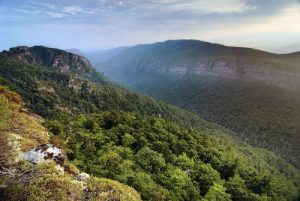
Man, that is an awesome photo of the gorge.
Awesome hike… i’vbe done it before. Only it is technically Harper Creek Falls trail, not Harpers Creek…