Mt. Mitchell - Deep Gap: Out and back - Member Hike
| Hike Name: | Mt. Mitchell - Deep Gap: Out and back |
|---|---|
| Country: | United States |
| State: | North Carolina |
| Nearby Town: | Marion |
| Rating: |  |
| Directions: | From I-40, east of Asheville, take exit 86, NC 226 to Marion/Shelby. NC 226 merges with US 221 and US 70 in Marion. Keep left on US 70. After about two miles, turn north on NC 80. Follow NC 80 north/northeast for 16 miles. Turn left onto the Blue Ridge Parkway. Follow the parkway to mile marker #355 and turn right onto NC 128, which leads to the park. |
| Total Hike Distance: | 13.00 miles |
| Hike Difficulty: | Difficult |
| Permit Required: | No |
| Hike Type: | In & Out, Backtrack Hike |
| Hike Starts/Ends: | Mt. Mitchell State Park Entrance - Old Mitchell Trail |
| Trails Used: | Old Mitchell Trail to Mt. Mitchell Summit. From Mt. Mitchell to Deep Gap Campground via Deep Gap Trail |
| Backcountry Campsites: | No |
| Backcountry Water Sources: | Streams |
| Management: | State Park Service |
| Contact Information: | Mt. Mitchell State Park 2388 State Highway 128, Burnsville, NC 28714 (828) 675-4611 http://www.ncparks.gov/Visit/parks/momi/main.php |
| Best Season: | Spring, Summer, Fall |
| Users: | Hikers |
| Road Conditions: | Maintained Gravel or Dirt Roads, Unmaintained Gravel or Dirt Roads |
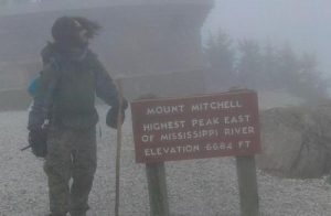
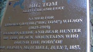
| Hike Summary: | Begin at Mt. Mitchell state park entrance. Follow Old Mitchell trail to Mt. Mitchell Summit (2.0 mi). From Mt. Mitchell Summit follow tower trail back to parking lot. From summit parking lot, follow Deep Gap Trail. Weave through picnic tables to leave the maintained park trails in lieu of unmaintained dirt trails. Follow Deep Gap trail to 4 more 6000'+ summits: Big Tom, Mt. Craig, Cat tail peak, and Balsam Cone (4.0 mi). Follow Deep Gap trail from Cat tail peak to Deep Gap Campground (0.5 mi). EAT/SLEEP WAKE-UP/EAT Return to Mt. Mitchell summit via Deep Gap trail (4.5 miles). Arrival to Mt. Mitchell summit then follow Old Mitchell Trail back to park entrance (2.0 miles). |
Recommended
Trip Reports
There are no Trip Reports yet.


 Trail Map For This Area
There are no comments yet.