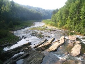
Lake Jocassee - Member Hike
| Hike Name: | Lake Jocassee |
|---|---|
| Country: | United States |
| State: | North Carolina |
| Nearby Town: | Rosman |
| Rating: |  |
| Directions: | Turn off US 64 near Rosman, head South, and follow the signs to the trailhead which is on your right. |
| Total Hike Distance: | 10.50 miles |
| Hike Difficulty: | Difficult |
| Permit Required: | Yes |
| Hike Type: | In & Out, Backtrack Hike |
| Hike Starts/Ends: | Frozen Creek Road |
| Trails Used: | Canebrake Trail |
| Backcountry Campsites: | Yes |
| Backcountry Water Sources: | Streams, Lakes |
| Management: | State Park Service |
| Contact Information: | Gorges State Park NC 281 South P.O. Box 100 Sapphire, NC 28774-0100 Office Phone: (828) 966-9099 |
| Best Season: | Winter, Spring, Summer, Fall |
| Users: | Hikers, Dogs |
| Road Conditions: | Primary Paved Roads, Secondary Paved Roads |
| Hike Summary: | This hike to Lake Jocassee starts at the parking area off Frozen Creek Road and descends gradually on the Canebrake Trail to a designated campground and a lengthy suspension bridge over the Toxaway River. Note: Many of the park's facilities are still being developed, so information, rules and regulations are subject to change. |
Recommended
Trip Reports
There are no Trip Reports yet.


 Trail Map For This Area
There are no comments yet.