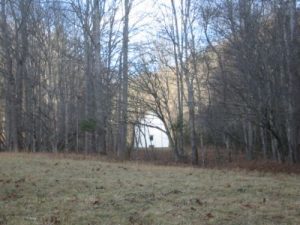
Great Smoky Mountain National Park - Hemphill Bald - Member Hike
| Hike Name: | Great Smoky Mountain National Park - Hemphill Bald |
|---|---|
| Country: | United States |
| State: | North Carolina |
| Nearby Town: | Waynesville |
| Rating: |  |
| Directions: | The most direct route to the southern trailhead at Big Fork is to take Cove Creek Road (partially graveled) off route 276 near Dellwood, NC into Cataloochee. A more scenic route (not recommended for RVs) is to take a long winding road, route 32, from Cosby, TN to the TN/NC border. Here the road becomes gravel. It twists and winds into Cataloochee. The Big Fork Ridge trailhead is at the end of the Cataloochee Road where the Rough Fork Trail also ends at a small parking area. The northern trailhead for the Little Cataloochee Trail is located a few miles south of Mt. Sterling Gap. |
| Total Hike Distance: | 34.90 miles |
| Hike Difficulty: | Very Difficult |
| Permit Required: | Yes |
| Hike Type: | One-Way, Shuttle Hike |
| Hike Starts: | Big Fork Trailhead (Cataloochee Road) |
| Hike Ends: | Little Cataloochee Trailhead |
| Trails Used: | Big Fork Ridge Trail, Caldwell Fork Trail, Hemphill Bald Trail, Polls Gap Trail, Palmer Creek Trail, Little Cataloochee Trail |
| Backcountry Campsites: | Yes |
| Backcountry Water Sources: | Streams, Springs, Snow |
| Management: | National Park Service |
| Contact Information: | Great Smoky Mountains National Park 107 Park Headquarters Road Gatlinburg, TN 37738 (865) 436-1200 http://www.nps.gov/grsm/index.htm |
| Best Season: | Winter, Spring, Fall |
| Users: | Hikers, Horses |
| Road Conditions: | Primary Paved Roads, Secondary Paved Roads, Maintained Gravel or Dirt Roads |
| Hike Summary: | This loop hike starts at the Big Fork Ridge trailhead at the end of the Cataloochee Road. The route climbs the Big Fork Ridge trail to the Caldwell Fork and meets up with the Hemphill Bald Trail for a ridge walk across Hemphill Bald and Little Bald Knob. The route then climbs to Polls Gap and temporarily uses the Balsam Mountain Road for a long road walk toward Pin Oak Gap (until the Polls Gap Trail is reopened). Balsam Mountain Campground is passed in the process of taking this lengthy re-route. Just before Pin Oak Gap, the Palmer Creek Trail descends 1000’ feet to the Little Cataloochee Trail where the route crosses a series of roads and returns to a parking area just south of Mt. Sterling Gap at 3000’. |
Recommended
Trip Reports
There are no Trip Reports yet.


 Trail Map For This Area
One reply on “Great Smoky Mountain National Park - Hemphill Bald - Member Hike”
This was our planned route, but we had to abandon it due to poor weather conditions.