Buckwheat Knob/Bennet Gap - Pisgah National Forest - Member Hike
| Hike Name: | Buckwheat Knob/Bennet Gap - Pisgah National Forest |
|---|---|
| Country: | United States |
| State: | North Carolina |
| Nearby Town: | Brevard |
| Rating: |  |
| Directions: | From Brevard go west (actually going North out of Brevard) on 276. Follow 276 into Pisgah NF. Follow 276 for about 14 + miles from the entrance. Watch for FS road 477 on the right, just before reaching the Cradle of Forestry Visitor Center. Take FS 477 for maybe ¼ mile to a very limited parking area on the left next to the sign for the Club Gap trail. |
| Total Hike Distance: | 8.00 miles |
| Hike Difficulty: | Difficult |
| Permit Required: | No |
| Hike Type: | In & Out, Backtrack Hike |
| Hike Starts/Ends: | Club Gap Trail Head |
| Trails Used: | Club Gap, Buckwheat Knob, Bennet Gap |
| Backcountry Campsites: | No |
| Backcountry Water Sources: | Streams |
| Management: | U.S. Forest Service |
| Contact Information: | Pisgah Ranger District 1001 Pisgah Highway Pisgah Forest, NC 28768 (828) 877-3265 |
| Best Season: | Winter, Fall |
| Users: | Hikers, Bikers |
| Road Conditions: | Primary Paved Roads, Maintained Gravel or Dirt Roads |
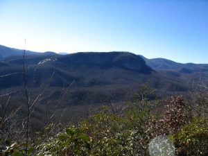
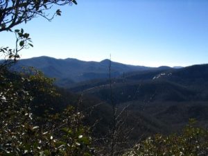
| Hike Summary: | I'll describe the hike we did then give you another option or two. Basically take the Club Gap trail which initially skirts the border of the Forestry Discover Center then heads up the mountain very steeply. Club Gap trail is just under a mile long but REALLY steep, hence the difficult rating. At the top of the ridge intersect with the Buckwheat Knob trail to the right, Avery Creek trail straight ahead, and the Black Mt. trail to the left. Take the right and eventually climb some more to the summit of Buckwheat Knob, for something of a disappointing view - winter views only - but nice enough. Continue down the other side to Bennet Gap. At the gap cross the road, go left for maybe 100 feet and turn right onto the Bennet Gap trail. After an initial pretty gradual climb you will follow a ridge line with some very nice views on both left and right. We continued to Coontree Mountain (you'll know when you pass the summit here as it heads down steeply) where we turned around and went back to a nice overlook on the Southwest side of the ridge where we ate lunch. Then back the way we came to the parking area. A shorter and much less strenuous hike could be done by continuing on FS 477 to Bennett Gap, parking there and then taking the Bennett Gap trail along the ridge. If I had know what a disappointment Buckwheat Knob was to be, I'd have started on the Coontree Loop trail and gone up one side of the loop to Bennett Gap trail and Coontree Mt. to the ridge, then backtracked using the other half of the Loop trail. The Coontree Loop trail head is near the Coontree picnic area, maybe 5 miles after the forest entrance on 276. So several options. Take your pick and have a great hike. |
Recommended
Trip Reports
There are no Trip Reports yet.


 Trail Map For This Area
There are no comments yet.