Art Loeb Trail - Member Hike
| Hike Name: | Art Loeb Trail |
|---|---|
| Country: | United States |
| State: | North Carolina |
| Nearby Town: | Transylvannia |
| Rating: |  |
| Directions: | The Blue Ridge Parkway (south from 276, north from 215) to 816. Take 816 to the very end where there is a large parkinglot with rest room facilities. The lot does fill on weekends. It is a starting point for a lot of dayhikers as well. |
| Total Hike Distance: | 18.00 miles |
| Hike Difficulty: | Very Difficult |
| Permit Required: | No |
| Hike Type: | In & Out, Backtrack Hike |
| Hike Starts/Ends: | Black Balsam Trail Head |
| Trails Used: | Art Loeb, Cold Mountain Trail |
| Backcountry Campsites: | Yes |
| Backcountry Water Sources: | Springs |
| Management: | National Park Service |
| Contact Information: | Pisgah Ranger District 1001 Pisgah Highway Pisgah Forest, NC 28768 (828) 877-3265 http://ncnatural.com/NCUSFS/Pisgah/pisgdst.html http://www.pisgahforest.com/public-lands/pisgahnationalforest/ |
| Best Season: | Spring, Fall |
| Users: | Hikers |
| Road Conditions: | Secondary Paved Roads, Maintained Gravel or Dirt Roads |
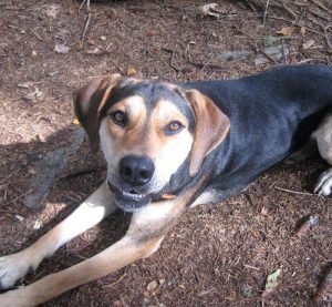
| Hike Summary: | The hike was planned in advance with three days saved for the trek. The planned route was Art Loeb north, camp at Deep Gap, slack pack to Cold Mountain, loop back on the East Fork Trail and loopp around on the Grassy Cove Trail. The mileage was very doable, as I saw it here in my home in NJ. Our first stop was at the visitors center for a check on water, bear, and trail conditions. The ranger liked our plan but commented how enthusiastic it was and reminded us it was a a wilderness area and we should "maybe rethink" it. Yea right. We found our way to the trail head and eventually to the fire road (101) which would lead to the Art Loeb (146). 101 was a wide fire road which followed the side of Black Balsam, we missed the quick entrance to AL right off the lot which would have taken us over Black Balsam. 101 eventually came to a wide open area with several trails heading off. No blazes, no signs. The map was a necessity. The AL went up over Tennent Mt, skirted Grassy Cove Top, thru Flower Gap (water source) to Shining Rock. The trail is unblazed and can be confusing, the trail is well worn, but there are numerous side trails that lead to camp sites. We found ourselves checking them to insure we weren't missing the trail. Some nice grassy sites with views. The trail lead us to Shining Rock a cool outcrop of quartz with a great view from the top. About 4 miles in. After lunch we continued on, but couldn't find the trail, initially. The path wasn't visible any where and the map had four trails converging. The trail was found below the rock about 25 yards and continued to the right (with your back to the rock). Its a wide trail at this point but quickly closes to a single track trail. The trail is truly a wilderness trail with little maintenance and no blazes, none. We had planned on camping at Deep Gap but with out signs and getting confused at Shining Rock we lost track of our position and continued on to Cold Mt. Deep Gap was found, after the fact, to be a grassy area that could hold several camp sites. There was an apple tree to the right as the AL came into it. The AL veers to the left and the CM goes straight ahead. The CM gains some quick altitude passes a water source, small trickle, and then several camp sites on the left. We set up here for the night. In the AM we slacked to the top and found it worth it, a rock outcrop 25 feet short of the top offers a great view. At this point our trip took a turn. A dog passed us on the trail earlier in the day showed up on the mountain, lost, hungry and thirsty. We changed plans to save the dog, a good boy. We got him down, sharing trail bars and our mac and cheese. He was burping trail bar by the time we got down, funny. We got him to his owner and all was good. The area is a wilderness area, with a tough trail. I questioned my being at one point. we never would have completed the enthusiastic plan. "Dog" probably saved us too. We had the nat geo Map #780 Pisgah Ranger District but I recommend the Shining RockWilderness and Middle Prong Wilderness map by the US Department of Agriculture (Forestry Service). The second map had the more current GPS datum 1987. |


 Trail Map For This Area
There are no comments yet.