Whitewater Creek - Gila Wilderness - Member Hike
| Hike Name: | Whitewater Creek - Gila Wilderness |
|---|---|
| Country: | United States |
| State: | New Mexico |
| Nearby Town: | Reserve |
| Rating: |  |
| Directions: | Take I-10 W toward DEMING. Take US-180 north Until you see the signs indicating you are approaching Glenwood and Forest Service service signs indicating The Catwalk. You need to be watching carefully, because the signs aren't easy to see. You will need to turn right (east) on NM Hwy. 174 (Catwalk Road). Follow that to the end, and there you are. |
| Total Hike Distance: | 24.80 miles |
| Hike Difficulty: | Difficult |
| Permit Required: | No |
| Hike Type: | One-Way, Shuttle Hike |
| Hike Starts: | Bighorn Campground |
| Hike Ends: | Gilita Campground |
| Trails Used: | I have no idea what the trail number is from The Catwalk going up Whitewater Creek, as I never did see a sign. However, there is only one trail to take. Follow it until you reach the Crest Trail at Hummingbird Springs, and turn north on the Crest Trail. Follow the Crest Trail until you can see Iron Lake below you to your north. There is another numberless but well defined trail which takes you from the crest to Iron Lake. |
| Backcountry Campsites: | Yes |
| Backcountry Water Sources: | Streams, Rivers, Springs |
| Management: | U.S. Forest Service |
| Contact Information: | Gila National Forest 3005 E. Camino del Bosque Silver City, NM 88061 (505) 388-8201 http://www2.srs.fs.fed.us/r3/gila/ |
| Best Season: | Spring, Summer, Fall |
| Users: | Hikers, Horses |
| Road Conditions: | Primary Paved Roads, Maintained Gravel or Dirt Roads |
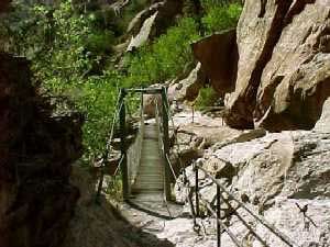
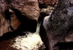
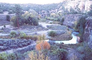
| Hike Summary: | This is by far my favorite hike in New Mexico. The trip starts off down The Catwalk, which is a suspended metal bridge system following the route of an old water line from the mining days of the late 1800's. When you come off the Catwalk, just to your south on the hillside are the remains of the ore processing mill, which was the location of the town of Graham. From that point the trip will be very wet. You will cross the creek between 25 and 30 times, depending on your hiking style. The water is clear, cold, and delicious. There is no fishing on Whitewater Creek, as the native fish were all killed by cyanide contamination over 100 years ago. The water is fine now, but the Fish & Game department hasn't yet restocked the fish population. Whitewater Creek is narrow and steep sided, and should be approached with caution during rainy weather. I have personally seen 8 foot walls of water come roaring down the canyon after rain upstream. It is also a beautiful hike, with great rock formations, and beautiful pools for swimming. At about the 16 mile mark is a large clear area shown on the map as Redstone Park. It isn't actually a park, but it is a spectacular place to camp, and is really just a large grassy meadow. Past that you will hit a tough climb to get out of the canyon and up to Hummingbird Springs, which ALWAYS has water. From Hummingbird, the view is 75+ miles in every direction, and you will understand why you made the trip. |


There are no comments yet.