Three Rivers Canyon - White Mountain Wilderness - Member Hike
| Hike Name: | Three Rivers Canyon - White Mountain Wilderness |
|---|---|
| Country: | United States |
| State: | New Mexico |
| Nearby Town: | Carrizozo |
| Rating: |  |
| Directions: | To reach the trailhead, take U.S. Highway 54 north out of Tularosa approximately 16 miles to the intersection with Forest Road 579. Turn right (east) onto Road 579 and proceed another 14 miles to the Three Rivers Campground. The first five miles of Road 579 are paved with the remainder consisting of improved gravel. The route is easily traveled by car. Proceed through the campground to an oval parking area located at the trailhead. |
| Total Hike Distance: | 17.90 miles |
| Hike Difficulty: | Moderate |
| Permit Required: | No |
| Hike Type: | Roundtrip, Loop Hike |
| Hike Starts/Ends: | Three Rivers Campground |
| Trails Used: | Three Rivers Trail (44) to Crest Trail (25). Go north to Dry Canyon Trail (46) and follow it back to Three Rivers Trail (44) |
| Backcountry Campsites: | Yes |
| Backcountry Water Sources: | Streams, Springs, Snow |
| Management: | U.S. Forest Service |
| Contact Information: | Lincoln National Forest 1101 New York Ave. Alamogordo, New Mexico 88310 (505) 434-7200 |
| Best Season: | Spring, Summer, Fall |
| Users: | Hikers, Dogs, Horses |
| Road Conditions: | Primary Paved Roads, Maintained Gravel or Dirt Roads |
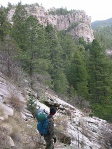
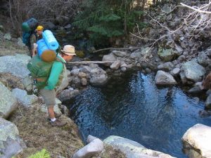
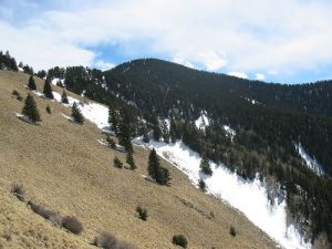
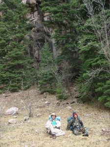
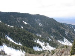
| Hike Summary: | This is a wonderful hike for southern New Mexico, as there is fresh water along a large percentage of the trip. The hike starts slowly and climbs fairly gently through most of its length. After a distance of 6 miles or so on Trail 44, downed timber starts to be a problem, and the trail is easily lost if you don't pay attention. Three Rivers Creek Flows alongside you for most of the climb, and contains several pools with easily visible groups of Cutthroat Trout. Three Rivers Creek actually springs from the ground at approximately the 5.3 mile mark. This is an excellent place to water, as the next water is a very steep 3 miles away. At the 7 mile mark, the climb reaches the back of Three Rivers Canyon, and the trail becomes MUCH steeper. Also, there is a beautiful Mountain Lion that dens in this area, and there are many elk kill sites in the lower part of the bowl. Don't touch the lion's elk. This can lead to the lion having a problem with your presence. After climbing the bowl, you will find Crest Trail #25 running north to south almost along the spine of the ridge. It is a large and easily visible trail with almost no obstructions. The view from this point is quite spectacular, and you can see the Organ Mountains to the west, and the San Mateos to the northwest. Follow trail #25 north/northwest around White Horse Hill to Dry Canyon. Here you will pick up Dry Canyon Trail #46, which will lead you back to the car. This is alos your last available water point for many miles, so make sure to hit Bonito Seep, which is a few hundred yards east of where trail 25 meets trail 46. The trail down Dry Canyon is covered by many downed trees from a fire several years ago, and can be impossible to follow at times. However, the canyon only leads one way, so simply follow it down until it rejoins trail #44, and follow it back to your car. The Three Rivers Canyon area is one of the most beautiful in southern New Mexico. Trail pressure is very light, and you can expect to hike for two or three days and see only a couple of other people, even on a holiday weekend. Excellent backwoods campsites are available everywhere, firewood is plentiful, and water is too, until you get out of Three Rivers itself. Deer, bear, turkey, elk, and lots of small species are abundant. |
Recommended
Trip Reports
| Date | Rating | Duration | Hiker | |
|---|---|---|---|---|

|
December 3, 2005 |  |
2 days | psyodin |

|
July 22, 2001 |  |
8 hours | Ferret |
|
April 3, 2003 |  |
3 days, 4 hours | Oshow |


2 replies on “Three Rivers Canyon - White Mountain Wilderness - Member Hike”
Tried this hike yesterday and was greeted by two bear cubs followed by mama at the 1.75 mile mark. They continued our way, so we turned around. Absolutely beautiful! Will try again this weekend!
i am taking my kids here. sounds great