Delaware Water Gap NRA - Mt. Tammany - Member Hike
| Hike Name: | Delaware Water Gap NRA - Mt. Tammany |
|---|---|
| Country: | United States |
| State: | New Jersey |
| Nearby Town: | Delaware Water Gap, PA |
| Rating: |  |
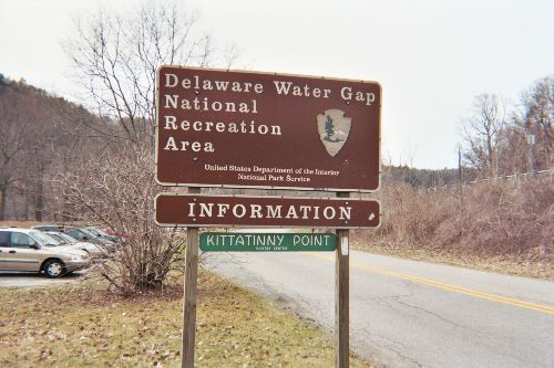
| Directions: | For Kittatinny Point Visitor Center and to enter the New Jersey side of the park: WESTBOUND on Interstate 80 take NJ Exit 1 and bear left 500 yards, or EASTBOUND on Interstate 80 take the first exit ramp after the Delaware River toll plaza (no toll eastbound) and continue straight off the ramp 300 yards. To enter the Pennsylvania side of the park, from Interstate 80 take PA exit 309 and Route 209 north 10 miles to Bushkill PA. New York City NY is 80 miles east; Philadelphia PA is 135 miles south; Scranton PA is 50 miles west. |
| Total Hike Distance: | 4.00 miles |
| Hike Difficulty: | Moderate |
| Permit Required: | No |
| Hike Type: | Roundtrip, Loop Hike |
| Hike Starts/Ends: | Dunnfield Parking Area |
| Trails Used: | Appalachian Trail, Blue-Blazed Trail, Red Dot Trail (M.T. Tammany) |
| Backcountry Campsites: | No |
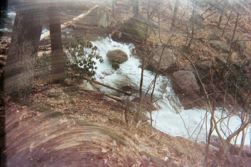
| Backcountry Water Sources: | Streams |
| Management: | National Park Service |
| Contact Information: | Delaware Water Gap National Recreation Area Bushkill, PA 18324 570-588-2451 www.nps.gov/dewa |
| Best Season: | Fall |
| Users: | Hikers, Dogs |
| Road Conditions: | Primary Paved Roads |
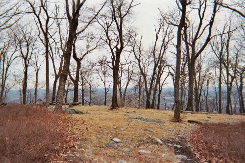
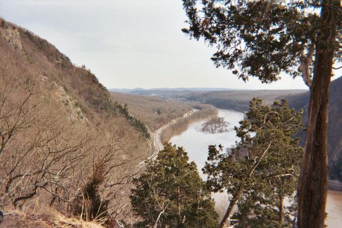
| Hike Summary: | This loop hike begins at the Dunnfield parking area just off I-80 near the Delaware Water Gap NRA visitor's center. The route follows the Blue Blazed Trail (which shares the first 0.3 miles with the Appalachian Trail) for to the top of Mt. Tammany after 2.5 miles. The Blue Blazed Trail ends at the summit, but you can follow the Red Dot Trail (also known as the Mt. Tammany Trail) back down to the parking area. This hike begins with a pleasant walk along a stream then makes a slow and gradual 1250 foot ascent to Mt. Tammany which has outstanding 180 degree views of the gap and the Delaware River. It can be hiked in either direction but is probably easiest if walked clockwise (which is described here.) |


There are no comments yet.