Wheeler Peak - Great Basin National Park - Member Hike
| Hike Name: | Wheeler Peak - Great Basin National Park |
|---|---|
| Country: | United States |
| State: | Nevada |
| Nearby Town: | Baker, Nevada |
| Rating: |  |
| Directions: | The Wheeler Peak Scenic Drive in the Great Basin National Park ends in a parking area next to the Wheeler Peak campground. However, the trailhead (39o1.04'N 114o18.20'W and elevation 10161ft) for this hike is a turnout at the side of the road about 0.7mi before you reach this terminus. There is ample trailhead parking at the turnout on the west side of the road and the peak trail is well indicated |
| Total Hike Distance: | 8.60 miles |
| Hike Difficulty: | Difficult |
| Permit Required: | No |
| Hike Type: | In & Out, Backtrack Hike |
| Hike Starts/Ends: | turnout near the end of the Wheeler Peak Scenic Drive |
| Trails Used: | Wheeler Peak/Alpine Lake Trail |
| Backcountry Campsites: | No |
| Backcountry Water Sources: | Snow |
| Management: | National Park Service |
| Contact Information: | Great Basin National Park 100 Great Basin National Park Baker, NV 89311 Park Headquarters (775) 234-7331 |
| Best Season: | Summer, Fall |
| Users: | Hikers |
| Road Conditions: | Primary Paved Roads, Secondary Paved Roads |
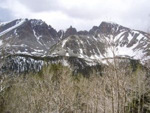
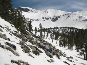
| Hike Summary: | Best time for this hike is July through September. Deep snow near the top is likely other months. This hike should be started very early in the day because of the risk of afternoon storms. Along most of the route, the trail follows the ridge up to the Wheeler Peak summit. It is easiest to begin the hike from the Summit Trail parking area. The initial section of the trail is almost level as it contours through the Engelmann spruce forest toward Stella Lake. About 1mi from the start you emerge onto a very pretty meadow and come to a trail junction at 39o0.47'N 114o19.06'W. The trail to the summit switchbacks round to the right but, before starting in that direction, walk straight ahead about 100yds to the north shore of Stella Lake (39o0.36'N 114o19.12'W and elevation 10380ft). This jewel of crystal clear water surrounded by pine forest reflects the backdrop of Wheeler Peak looming high above its southern shore. Returning to the trail junction, you follow the switchback that climbs toward the ridge off to the west. The trail is still easy here with a gentle gradient all the way up through light forest and open meadows to a saddle in the ridge at 39o0.32'N 114o19.38'W and an elevation of 11000ft. This elevation coincides with the treeline and here a number of ancient bristlecone pines dot the rock-strewn landscape. Beyond the saddle, the increasingly rough and faint trail switchbacks up the broad treeless apex of the ridge to the south of the saddle. A rough use-trail winds through, around and over the boulders as you begin the climb up the last 1000ft to the summit. For most of this climb you stay on the apex of the ridge with steep drops not far away on both sides. Almost at the top, there is, even in high summer, a fairly large snow field that you may be able to bypass on either the left or right. Spectacular all around views welcome you to the 13063ft summit. |


One reply on “Wheeler Peak - Great Basin National Park - Member Hike”
Wow. Never would have thought you could that much snow in Nevada in the summer.