Glacier National Park - Highline Trail - Member Hike
| Hike Name: | Glacier National Park - Highline Trail |
|---|---|
| Country: | United States |
| State: | Montana |
| Nearby Town: | Kalispell |
| Rating: |  |
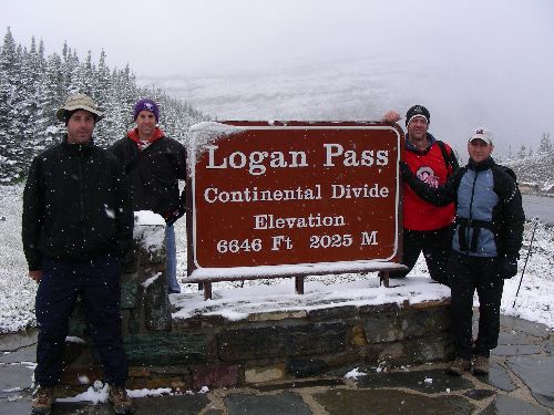
| Directions: | From Kalispell, Montana, take US 2 East. Go approximately 32 miles and turn left on the Going-to-the-Sun Road. Take the Going-to-the-Sun Road for approximately 32 miles to the summit and go to the Logan Pass Visitor Center. |
| Total Hike Distance: | 11.60 miles |
| Hike Difficulty: | Easy to Moderate |
| Permit Required: | No |
| Hike Type: | One-Way, Shuttle Hike |
| Hike Starts: | Logan Pass Visitor Center |
| Hike Ends: | The Loop on the Going-to-the-Sun Road |
| Trails Used: | Highline Trail |
| Backcountry Campsites: | No |
| Backcountry Water Sources: | Streams, Snow |
| Management: | National Park Service |
| Contact Information: | Glacier National Park Park Headquarters P.O. Box 128 West Glacier, Montana 59936 Phone: (406) 888-7800 Fax: (406) 888-7808 www.nps.gov/glac/index.htm |
| Best Season: | Summer |
| Users: | Hikers |
| Road Conditions: | Primary Paved Roads |
| Hike Summary: | The area that is now Glacier National Park was first made a Forest Preserve in 1900, and was later established as the country’s tenth national park in 1910. Glacier and the adjacent Waterton Lakes National Park to the north in Canada were named as a World Heritage Site in 1995. Glacier alone offers over 700 miles of trails, which afford incredible views of spectacular mountain sides and glacial valleys, unspoiled alpine lakes and forests, and a variety of wildlife. This particular hike along the Highline Trail, also known as the Garden Wall Trail, begins at the Logan Pass Visitor Center, and ends at The Loop on the Going-to-the-Sun Road. The trail parallels the continental divide along the foreboding Garden Wall for the first 7.6 miles between the visitor center and the Granite Park Chalet. The Garden Wall is an arête, which is literally defined in Merriam-Webster’s Online Dictionary as “a sharp-crested ridge in rugged mountains.” Despite the ominous sound of this definition, this first part of the trail is relatively flat, gaining only 200 feet between the visitor center and the chalet. The chalet is a great place to stop and have lunch and chat with fellow hikers. The ambience is awesome. From the chalet, the hike takes a turn for the steeper, and descends nearly 2,200 feet over the last 4 miles. This part of the hike meanders through a section of forest that has recently been affected by fire. The blackened bare trees are a stark contrast to the lush greens that exist below the tree line along the first part of this hike. Bighorn sheep and mountain goat are abundant along the first part of this hike, while signs of bear are present along the second part. With a sharp eye, one might even spot one on the adjacent hillsides. |


2 replies on “Glacier National Park - Highline Trail - Member Hike”
Thanks for the feedback. Sounds like this trail carries a lot of good memories for you. I can’t imagine traversing that part of the trail in high winds without the cable. Like your pics as well.
My dad and I celebrated his 75th birthday on this trail, our personal favorite, back in 1998, which was our swansong for hiking the Highline Trail. It was the 13th time Dad had hiked the trail and my 8th time. We always did the roundtrip from Logan Pass – Granite Park Chalet and back to Logan Pass, making it 15.2 miles. That section with the sheer cliff and the cable handrail (inside the garden hose in your picture) is pretty nerve-wracking when they remove the cable in September — especially when you have a good stiff wind blowing! Love your pics!