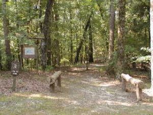
Hugh White State Park Trail System - Member Hike
| Hike Name: | Hugh White State Park Trail System |
|---|---|
| Country: | United States |
| State: | Mississippi |
| Nearby Town: | Grenada and Grenada Lake |
| Rating: |  |
| Directions: | Take Highway 8 East of Grenada. A few miles outside of town will be a sign to the left for the park. Follow this road until you see Little Mountain and the trailhead on the left. If you come to an intersection (Old Highway 8) you have gone past the trail. |
| Total Hike Distance: | 4.00 miles |
| Hike Difficulty: | Easy to Moderate |
| Permit Required: | No |
| Hike Type: | Roundtrip, Loop Hike |
| Hike Starts/Ends: | trailhead at the base of Little Mountain |
| Trails Used: | Hugh White State Park Trail System |
| Backcountry Campsites: | No |
| Backcountry Water Sources: | Streams, Springs |
| Management: | State Forest Service |
| Contact Information: | Address: P.O. Box 725 Grenada, MS 38902 phone 662.226.4934 hughwhite@mdwfp.state.ms.us Location: Five miles east of Grenada off Mississippi Highway 8. Manager: Donny English Office Hours: The Park office is open from 8:00 am - 5:00 pm daily except Thanksgiving, Christmas, and New Year's Day. http://www.mdwfp.com/parkView/parks.asp?ID=2812 |
| Best Season: | Winter, Spring, Summer, Fall |
| Users: | Hikers |
| Road Conditions: | Primary Paved Roads, Secondary Paved Roads |
| Hike Summary: | This state park, located east of Grenada and north of Grenada Lake has a nice little trail system that passes through a myriad of terrain types. I started my hike at the trailhead at the base of Little Mountain. Instead of going up the mountain I save that for later and turn right heading down into a hollow. The trail comes back up, crosses old highway 8 and goes back into the woods through another hollow area. It then comes to an old road where you can either continue to the lodge or take a shorter route to where the trail crosses the state park road. I like to take the trail to the left toward the lodge and come back down the state park road to the remainder of the trail. This makes for a longer loop. After coming out on the road I just follow it to where the trail starts on the other side of the state park road again. The trail goes down into a hollow, stays there for a while, and comes up to a pine covered hill. Many of these pines are dying for some reason and more than a few have been cut down. This would be a good place to look out for rattlers as the dead trees make a perfect environment for their prey, rodents. The trail then comes down into another hollow (wet and snakified when I hiked it) and then climbs back up to the state park road where you parked at the trailhead. But the hike is not over. Follow the trail you started on and instead of turning right, head left up the figure 8 trail on Little Mountain. This is a geologically unusual area for Mississippi. The ?mountain? is over 400 feet high and is capped off by large boulders, a rarity for Mississippi. One of the boulders, about the size of a refrigerator, had a water filled hole in it. Living in the hole was a frog that I did not recognize. Complete the figure 8 back down to the trailhead. While you are in the area check out the Lost Bluff Trail near the dam. This is from an email I got so check out the accuracy before you go. The only listing for hiking I have found so far is a .8 Mi nature trail. |


There are no comments yet.