Mount Arvon - Member Hike
| Hike Name: | Mount Arvon |
|---|---|
| Country: | United States |
| State: | Michigan |
| Nearby Town: | L’Anse |
| Rating: |  |
| Directions: | Mount Arvon is a bit difficult to get to. The best directions can be found here: https://www.summitpost.org/mount-arvon/151786 |
| Total Hike Distance: | 0.10 miles |
| Hike Difficulty: | Easy |
| Permit Required: | No |
| Hike Type: | In & Out, Backtrack Hike |
| Hike Starts/Ends: | Dirt Parking Area |
| Trails Used: | Not Applicable |
| Backcountry Campsites: | No |
| Backcountry Water Sources: | None |
| Management: | Private Property |
| Contact Information: | Unknown |
| Best Season: | Spring, Summer, Fall |
| Users: | Hikers, Dogs |
| Road Conditions: | Unmaintained Gravel or Dirt Roads, Four Wheel Drive Recommended, High Clearance Vehicle Recommended |
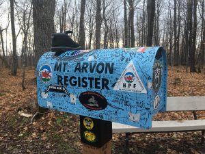
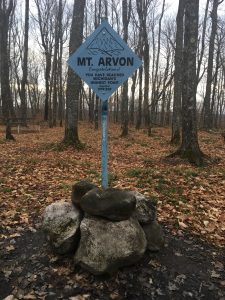
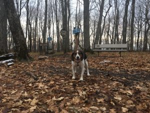
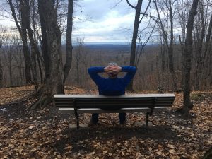
| Hike Summary: | Mount Arvon is the highest point in Michigan at 1,979 feet. Although this is an easy “hike,” getting to the parking area adjacent to the summit isn’t so easy. Mount Arvon is in the middle of nowhere and the roads are unimproved at best. I would highly encourage using the directions provided in the link above as opposed to plugging this destination into a GPS. And although the drive to the parking area can probably be made in a two-wheel drive car, for peace of mind, a four-wheel drive vehicle with additional clearance is highly recommended, especially if it has been raining or snowing. We were fully prepared to hike the last half mile to the summit. However, the road goes all the way to the top now, and so the “hike” is but a 50-foot walk to the benchmark. There is a small registration box located at the summit, a picnic table, and a couple park benches, one of which overlooks Lake Superior (see photos at right). Although it isn’t much of a hike, I’m still giving it four stars due to the fun and challenge of finding the parking area. |




There are no comments yet.