Baxter State Park - Katahdin Stream Falls - Member Hike
| Hike Name: | Baxter State Park - Katahdin Stream Falls |
|---|---|
| Country: | United States |
| State: | Maine |
| Nearby Town: | Millinockett |
| Rating: |  |
| Directions: | (Katahdin Stream Campground): From I-95, take Exit #56 towards Medway and Millinocket on 157/11 for 11.4 miles. In Millinocket, travel approximately 15 miles north on SR 11 to reach the Togue Pond Gate at Baxter State Park where there is an $8 entrance fee. From the gate, continue about seven miles to Katahdin Stream Campground which is on the right. Note: No motorhomes, motorcycles or pets are permitted in the park. |
| Total Hike Distance: | 2.40 miles |
| Hike Difficulty: | Easy to Moderate |
| Permit Required: | No |
| Hike Type: | In & Out, Backtrack Hike |
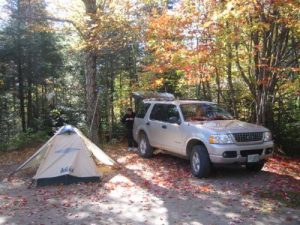
| Hike Starts/Ends: | Katahdin Stream Campground |
| Trails Used: | Appalachian Trail |
| Backcountry Campsites: | No |
| Backcountry Water Sources: | Streams |
| Management: | State Park Service |
| Contact Information: | Baxter State Park 64 Balsam Drive Millinocket, ME 04462 207-723-5140 www.baxterstateparkauthority.com |
| Best Season: | Fall |
| Users: | Hikers |
| Road Conditions: | Primary Paved Roads, Secondary Paved Roads, Maintained Gravel or Dirt Roads |
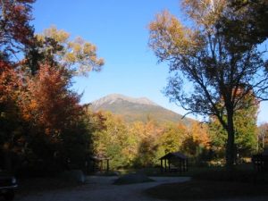
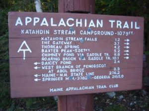
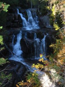
| Hike Summary: | The hike to Katahdin Stream Falls begins at the Katahdin Stream Campground in Baxter State Park and follows the Appalachian Trail just over a mile to an overlook which is located just left of the trail. It is a fairly easy climb to the falls, but the incline and trail difficulty increases dramatically in the next few miles if you choose to continue on to Mt. Katahdin. At 5,268 feet, the summit is 5.2 miles from the trailhead at the campground and 4.0 miles from the falls. Katahdin is best known as the northern terminus of the Appalachian Trail which is marked by a large brown and white sign and magnificent 360 degree views from the summit. |


There are no comments yet.