Haleakala National Park - Makahiku Falls - Member Hike
| Hike Name: | Haleakala National Park - Makahiku Falls |
|---|---|
| Country: | United States |
| State: | Hawaii |
| Nearby Town: | Hana |
| Rating: |  |
| Directions: | The Kipahulu area of the Park is at the east end of Maui between Hana and Kaupo. It can be reached via Highway 36, a curvy, often wet road. Kipahulu is about 90 miles from the resort areas of Wailea or Kaanapali, and 60 miles from central Maui. Driving time is about 3-4 hours each way. An extension of this road, Highway 31, goes around the dry side of the island, past Kaupo and on to Ulupalakua. It is only partially paved and can be hazardous or closed during periods of stormy weather. |
| Total Hike Distance: | 1.00 miles |
| Hike Difficulty: | Moderate |
| Permit Required: | No |
| Hike Type: | In & Out, Backtrack Hike |
| Hike Starts/Ends: | Kipahulu Visitor's Center |
| Trails Used: | The Pipiwai Trail |
| Backcountry Campsites: | No |
| Backcountry Water Sources: | Streams |
| Management: | National Park Service |
| Contact Information: | Haleakala National Park P.O. Box 369 Makawao, Maui, HI 96768 Visitor Information 808.572.4400 Headquarters 808.572.4400 |
| Best Season: | Winter, Spring, Summer, Fall |
| Users: | Hikers |
| Road Conditions: | Primary Paved Roads, Secondary Paved Roads, Maintained Gravel or Dirt Roads |
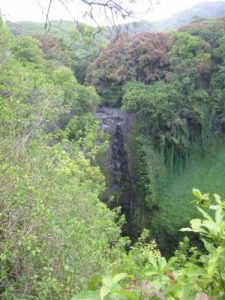
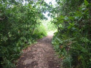
| Hike Summary: | The Pipiwai Trail is a moderately strenuous 4 mile (6.3km) round trip trail. It winds upslope along the edge of Pipiwai Stream past several waterfalls and pools. The remains of a sugar mill dam, irrigation systems, and flumes of the late 1800's can be seen in several places along the trail. The Makahiku Overlook is just .5 mile (.8km) up the trail and looks down on a beautiful 184-foot (56m) waterfall. Continue your hike over foot bridges above the stream and through the alien bamboo forest. The trail ends near the base of the 400-foot (122m) Waimoku Falls. Be prepared for rain, mud, and slippery mosses. Mosquitoes are very friendly here! |


There are no comments yet.