Yonah Mountain - Member Hike
| Hike Name: | Yonah Mountain |
|---|---|
| Country: | United States |
| State: | Georgia |
| Nearby Town: | Helen |
| Rating: |  |
| Directions: | From downtown Cleveland, Georgia, go north 0.3 mile on Highway 129. Turn right onto Georgia Highway 74 and go 2.2 miles. Turn right on Tom Bell Road and go 0.9 mile and take the 2nd right turn onto Chambers Road. Go 0.7 mile and turn right on Forest Service Road 323. Go 0.3 mile to the trailhead parking lot. Physical Address: 1900 Chambers Road, Cleveland, GA |
| Total Hike Distance: | 4.40 miles |
| Hike Difficulty: | Difficult |
| Permit Required: | No |
| Hike Type: | Roundtrip, Loop Hike |
| Hike Starts/Ends: | Yonah Mountain Parking Area |
| Trails Used: | Yonah Mountain Trail |
| Backcountry Campsites: | Yes |
| Backcountry Water Sources: | Springs |
| Management: | None |
| Contact Information: | Chattahoochee-Oconee National Forest Chattooga River District 9975 Highway 441 S Lakemont, GA 30552 706-754-6221 |
| Best Season: | Winter, Spring, Summer, Fall |
| Users: | Hikers, Bikers, Dogs |
| Road Conditions: | Primary Paved Roads, Secondary Paved Roads, Maintained Gravel or Dirt Roads |
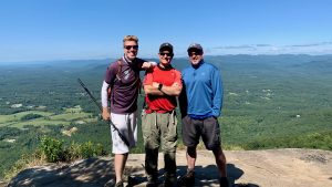
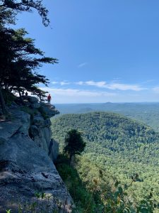
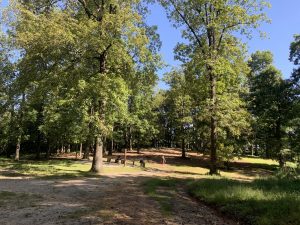
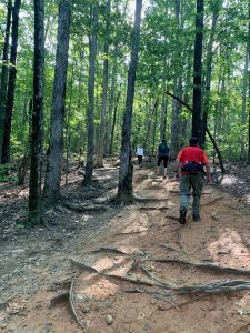
| Hike Summary: | The 2.2 mile climb to Yonah Mountain is a tough one and you gain ~1500 feet before you reach the summit. From the parking area, prepare for a long climb through a wooded forest before you reach a forest road and small US Army training camp after 1.6 miles. There is a small clearing and camping area here, and don't be surprised to see military personnel running various drills in the area. From here follow a rocky and rutted forest road another ~0.2 miles to a steep rock face with outstanding 180+ degree views to the west and to the ridgeline of the Appalachian Trail. It is a short distance from here to the actual summit of Yonah Mountain where there is a small meadow at 3166'. You can loop around from here back to the Army training area at 1.6 miles then continue your hike back to the parking area. This hike is a very popular one in the area, so try to get to the trailhead early if you plan to hike on a weekend. Also be extremely careful from the rock ledges near the top - especially if you have small children or pets. |
Recommended
Trip Reports
There are no Trip Reports yet.



There are no comments yet.