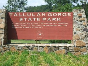
Tallulah Gorge North/South Rim Trail - Member Hike
| Hike Name: | Tallulah Gorge North/South Rim Trail |
|---|---|
| Country: | United States |
| State: | Georgia |
| Nearby Town: | Tallulah Falls |
| Rating: |  |
| Directions: | From Atlanta:Take I85 north to U.S. 441 North. From here the park is 33 miles to the north. |
| Total Hike Distance: | 2.00 miles |
| Hike Difficulty: | Moderate to Difficult |
| Permit Required: | No |
| Hike Type: | Roundtrip, Loop Hike |
| Hike Starts/Ends: | Jane Hurt Yarn Interpretive Center |
| Trails Used: | North Rim Trail Hurricane Falls Staircase South Rim Trail North Rim Trail |
| Backcountry Campsites: | No |
| Backcountry Water Sources: | None |
| Management: | State Park Service |
| Contact Information: | Tallulah Gorge State Park 338 Jane Hurt Yarn Dr Tallulah Falls, GA 30573 Park Office-(706)754-7970 Camping-(706)754-7979 http://www.gastateparks.org/info/tallulah/ |
| Best Season: | Spring, Summer, Fall |
| Users: | Hikers |
| Road Conditions: | Primary Paved Roads |
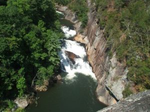
| Hike Summary: | A short hike around the gorge. Awesome views of the gorge from the various overlooks. Georgia Power was releasing water so there were no permits to the gorge floor however the hike around the gorge and the stairs to the bottom of the gorge were breathe taking. One can see all the overlooks without doing the staircase which would make it an easy trail however the distance would be about 3 miles. Fall would be a great time to visit. |


2 replies on “Tallulah Gorge North/South Rim Trail - Member Hike”
Unfortunately, there is no overnight camping in the Gorge.
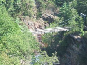
That’s an impressive suspension bridge. Is there any overnight backpacking in the Gorge?