| Hike Summary: |
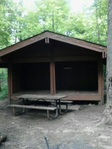
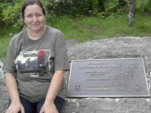
The AT trail from the parking area is a bit confusing as to which way goes to springer mountain but after consulting my guide book I realized that I had to cross the usfs road 42 and head up the hill upon which I was reassured by a sign which said springer mountain was 0.9 tenths of a mile ahead. After a short hike I passed a sign for the benton mackaye trail and then at approximately mile 0.8 tenths I saw a sign for the springer mountain shelter where you can get water from a spring, use the privy or stay the night in a three sided shelter with a loft and there are cables to hang your food on to keep it out of the reach of bears. After registering at the rock on top of Springer mountain I started down Springer mountain towards Amicalola falls state park. There is one shelter known as Black Gap in the guide books for the AT which is approximately 1.5 miles from the top of Springer mountain. The water is on the opposite side of the trail from this shelter which is about half the size of the one on top of springer mountain. It has a picnic table and there is a privy outback with bear cables to hang your food on. The hike down was not all down as I soon learned when I got to the nimble will gap. At last I reached Amicalola falls which was magnificent to see the rushing waters over the rocks as you descend down a stair case of 605 steps that winds back and forth before reaching the bottom then there is a short hike to the welcome center and the last shelter which is shortly before it which is screened in on the front and has bunk beds. |


There are no comments yet.