Neels Gap to Wolf Laurel Top - Member Hike
| Hike Name: | Neels Gap to Wolf Laurel Top |
|---|---|
| Country: | United States |
| State: | Georgia |
| Nearby Town: | Cleveland |
| Rating: |  |
| Directions: | Take US 19 and 129, north from Cleveland, GA and drive approximately 18 miles to the Byron Herbert Reese Park just a half mile past Neels Gap and the Walasi-Yi Center. |
| Total Hike Distance: | 8.00 miles |
| Hike Difficulty: | Moderate to Difficult |
| Permit Required: | No |
| Hike Type: | In & Out, Backtrack Hike |
| Hike Starts/Ends: | Byron Herbert Reese Park |
| Trails Used: | Appalachian Trail |
| Backcountry Campsites: | Yes |
| Backcountry Water Sources: | Springs |
| Management: | Other |
| Contact Information: | Georgia Appalachian Trail Club, Inc. P.O. Box 654 Atlanta, GA 30301 • (Voice Mail) 404-634-6495 |
| Best Season: | Winter, Spring, Summer, Fall |
| Users: | Hikers |
| Road Conditions: | Primary Paved Roads |
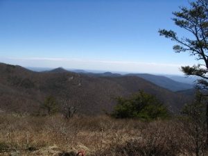
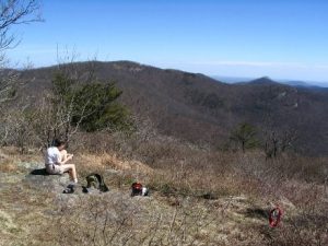
| Hike Summary: | We hiked from Byron Herbert Reese Park to Wolf Laurel Top on the Appalachian Trail. The terrain is moderately mountainous with outstanding views. Our lunchtime destination was Wolf Laurel Top but we were running a bit late and found a great overlook just before Wolf Laurel Top and ate there. Nice views to the Northeast from the overlook. This is an excellent hike on mountainous terrain that starts about a half mile beyond Neels Gap and joins the Appalachian Trail at Mountain Crossings at the Walasi-Yi store. The initial part of the hike is a half mile trek up highway 129 to Neels Gap and the AT. Then take the AT North. This is the only place on the AT where the trail goes through a store (actually a breezeway attached to the store). The initial climb to Levelland Mt. is relatively moderate, though fairly relentless. Once on the summit you will descend a bit to the ‘Levelland’ part – a relatively level ridge top. This level section is about a half mile long before it begins a steep descent (nice views here) to a lower ridge. The trail generally follows the ridge top with several small climbs and descents before the climb to Wolf Laurel Top. The last little summit before Wolf Laurel is where the overlook is. Watch for a side trail to the right at somewhere around the 3.5 mile mark. It is about 50 yards long and leads to a nice campsite with the overlook just beyond. On Wolf Laurel Top itself there's an open grassy spot just a few yards to the right of the trail with marvelous views to the south and east, also a wonderful lunch spot, though you may have to share the spot with other hikers. The roughest part of this hike is the ascent back up Levelland Mt. on the return trip. All in all though, a very nice hike. |
Recommended
Trip Reports
There are no Trip Reports yet.


One reply on “Neels Gap to Wolf Laurel Top - Member Hike”
Just did this hike last weekend. Fortunately no bear issues, but did cross paths with a rattlesnake!
https://n2backpacking.com/wolf-laurel-top-trip-report-may-31-2013/