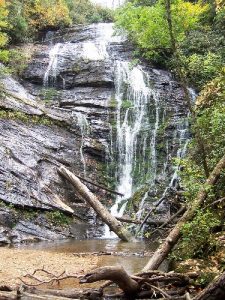
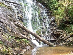
Kings Creek Falls - Member Hike
| Hike Name: | Kings Creek Falls |
|---|---|
| Country: | United States |
| State: | Georgia |
| Nearby Town: | Clayton |
| Rating: |  |
| Directions: | From Clayton, travel down Warwoman Rd until it runs into 28. Turn right onto 28 and follow 28 to Burrells Ford Rd (dirt/gravel). Follow this across the Chattooga to the parkng area on the left. |
| Total Hike Distance: | 1.50 miles |
| Hike Difficulty: | Easy |
| Permit Required: | No |
| Hike Type: | In & Out, Backtrack Hike |
| Hike Starts/Ends: | Burrells Ford Parking Area |
| Trails Used: | Chattooga River trail |
| Backcountry Campsites: | Yes |
| Backcountry Water Sources: | Streams |
| Management: | None |
| Contact Information: | Unknown |
| Best Season: | |
| Users: | Hikers |
| Road Conditions: | Secondary Paved Roads, Maintained Gravel or Dirt Roads, Unmaintained Gravel or Dirt Roads |
| Hike Summary: | From Burrells Ford Parking Area, the trail begins and winds down to meet with the Chattooga River trail. The trail to Kings Creek veers off the CRT and the falls are only a short hike away. Cross several small streams along th way. Easy hike with beautiful falls. |
Recommended
Trip Reports
There are no Trip Reports yet.


One reply on “Kings Creek Falls - Member Hike”
Kings Creek Falls and Burrell’s Ford Parking Area are in SC