High Shoal Falls - Member Hike
| Hike Name: | High Shoal Falls |
|---|---|
| Country: | United States |
| State: | Georgia |
| Nearby Town: | Hiawassee |
| Rating: |  |
| Directions: | From GA-17 N/GA-75 N make a sharp hairpin turn on to Indian Grave Gap Road in Towns County and follow it 1.3 miles to the trailhead. Note there is a creek crossing in the first half mile on Indian Grave Gap Road that may require a high clearance vehicle - especially in the spring season. |
| Total Hike Distance: | 2.40 miles |
| Hike Difficulty: | Moderate |
| Permit Required: | No |
| Hike Type: | In & Out, Backtrack Hike |
| Hike Starts/Ends: | Indian Grave Gap Road |
| Trails Used: | High Shoal Falls Trail |
| Backcountry Campsites: | Yes |
| Backcountry Water Sources: | Streams |
| Management: | U.S. Forest Service |
| Contact Information: | Chattahoochee National Forest |
| Best Season: | Winter, Spring, Summer, Fall |
| Users: | Hikers, Dogs |
| Road Conditions: | Primary Paved Roads, Secondary Paved Roads, Maintained Gravel or Dirt Roads |
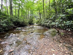
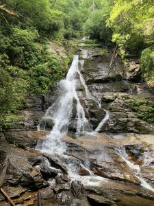
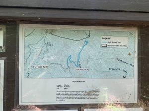
| Hike Summary: | This hike starts at a small trailhead on the gravel Indian Grave Gap Road that has room for ~4 cars. The quickest way here is from GA 17, but you have to cross a small stream to get here - so a high clearance vehicle is suggested. At the trailhead, The High Shoal Falls trail drops immediately and makes a steep decent to a large open area that has multiple campsites at a bridge that crosses High Shoal Falls Creek. Just after here about a mile in to the hike is a turn-off to the left that drops down to the first waterfall called Blue Hole Falls. It is a pretty one with a great swimming area at the base of the falls. From here, you can continue on another half mile to reach a platform that overlooks High Shoal Falls. It does not have a pool for swimming at it's base but is equally scenic and well worth the trip. From here, it is a ~500' climb back to the trailhead at from High Shoal Falls. |
Recommended
Trip Reports
There are no Trip Reports yet.


There are no comments yet.