Fort Pulaski - Member Hike
| Hike Name: | Fort Pulaski |
|---|---|
| Country: | United States |
| State: | Georgia |
| Nearby Town: | Savannah, Tybee Island |
| Rating: |  |
| Directions: | From I- 95, take exit for I-16 about 15 miles west of Savannah. From I-16, take U.S. Highway 80 East. Follow signs for Fort Pulaski, Tybee Island and beaches. Fort Pulaski National Monument entrance is approximately 15 miles east of Savannah. |
| Total Hike Distance: | 13.00 miles |
| Hike Difficulty: | Easy |
| Permit Required: | No |
| Hike Type: | Roundtrip, Loop Hike |
| Hike Starts/Ends: | Fort Pulaski Parking Lot |
| Trails Used: | North Pier Trail, Lighthouse Trail, Historic Dike System, Rail to Trail, Fort Pulaski itself |
| Backcountry Campsites: | No |
| Backcountry Water Sources: | None |
| Management: | National Park Service |
| Contact Information: | Mail P.O. Box 30757 Hwy 80 East Savannah, GA 31410-0757 Phone Visitor Information (912) 786-5787 Maintenance (912) 786-4086 Fax 912-786-6023 |
| Best Season: | Winter, Spring, Summer, Fall |
| Users: | Hikers, Bikers, Dogs |
| Road Conditions: | Primary Paved Roads, Secondary Paved Roads, Maintained Gravel or Dirt Roads |
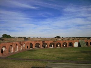
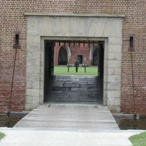
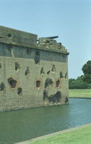
| Hike Summary: | Fort Pulaski offers an abundance of outdoor activities including, hiking, biking, walking trails, self-guided fort tours, as well as bird watching, and fishing. Fishing is allowed along the banks of the Savannah River and Cockspur Island, including the use of the Cockspur Island Bridge after the park closes. You must possess a valid fishing licence issued by the State of Georgia. Outdoor enthusiasts will enjoy exploring numerous trails throughout Fort Pulaski National Monument. Selected trails include: North Pier Trail This trail guides visitors through a scenic wooded environment and passes through remnants of Fort Pulaski's original construction village. Battery Hambright, built in the late 19th Century, and the historic north pier highlight this 1/4 mile trail. Lighthouse Trail The Lighthouse Trail guides visitors along open marsh as well as a forested environment offering views of the Savannah River, Tybee Island, and back towards Fort Pulaski. The 3/4 mile trail also offers the island's best views of the historic Cockspur Lighthouse. Historic Dike System Designed by Lt. Robert E. Lee, the historic dike system allowed for tide control and drainage which aided in the construction of Fort Pulaski. The two mile length trail circles Fort Pulaski, offering visitors unparalleled views of Cockspur Island and the Savannah River. McQueens Island Rails to Trails Located on McQueens Island at the entrance to Fort Pulaski National Monument, this six mile trail follows the path of the old Tybee Rail line that once connected Savannah to the beaches of Tybee Island. The packed-gravel trail is open to bikers, runners, and walkers. |


There are no comments yet.