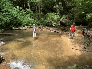
Fall Creek Waterfall - Member Hike
| Hike Name: | Fall Creek Waterfall |
|---|---|
| Country: | United States |
| State: | Georgia |
| Nearby Town: | Jasper |
| Rating: |  |
| Directions: | From GA 136 West, turn left onto Monument Road and drive 3.1 miles to the trailhead which sits across from a house on the ridgeline. |
| Total Hike Distance: | 4.40 miles |
| Hike Difficulty: | Moderate to Difficult |
| Permit Required: | No |
| Hike Type: | In & Out, Backtrack Hike |
| Hike Starts/Ends: | Mounument Road |
| Trails Used: | Fall Creek Trail |
| Backcountry Campsites: | Yes |
| Backcountry Water Sources: | Streams |
| Management: | State Forest Service |
| Contact Information: | Dawson Forest Wildlife Management Area Address: Dawsonville, GA 30534 Phone: (770) 535-5700 https://georgiawildlife.com/dawson-forest-wma |
| Best Season: | Winter, Spring, Summer, Fall |
| Users: | Hikers, Dogs |
| Road Conditions: | Primary Paved Roads, Secondary Paved Roads |
| Hike Summary: | This hike starts at the Monument Road trailhead and drops ~1200 feet to a waterfall at Fall Creek. The trail is mostly downhill with a short climb in the final half mile to navigate around a drainage that drops back down to Fall Creek. Make sure to stay on the Fall Creek Trail and stay left around the 0.3 miles mark where the Tobacco Road Trail breaks away to the right. The first part of the trail is on a wide gravel 4x4 road, but the last mile is mostly on a single track that winds through a heavily forested area occasionally following Fall Creek. When you bottom out near the waterfalls break from the Fall Creek trail and follow a sign that directs you to the waterfall which has a nice shallow pool at the base. Dawson Forest Wildlife Management Area requires a permit which you can only get online or through the phone. Check out https://georgiawildlife.com/dawson-forest-wma for details. |
Recommended
Trip Reports
There are no Trip Reports yet.


There are no comments yet.