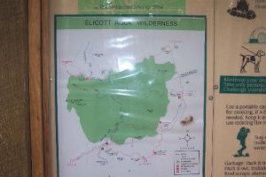
Ellicot Rock Wilderness - Member Hike
| Hike Name: | Ellicot Rock Wilderness |
|---|---|
| Country: | United States |
| State: | Georgia |
| Nearby Town: | Clayton |
| Rating: |  |
| Directions: | Courtesy of the Birdshooter: PARKING: (Burrell’s Ford Parking Area) - From US 76/US 441 in Clayton, GA (at Wendy’s), take a right onto Rickman Road for 0.5 miles to Warwoman Road. Turn right onto Warwoman Road and head 14 miles to State Route GA 28. Take a right onto GA 28 and follow it for 1.8 miles to U.S. Forest Service Road 646 (which is also known as Burrells Ford Road). Follow USFS 646 for 9.4 miles to the Burrell Ford Parking Area. USFS 646 will turn to gravel for a majority of this drive. In South Carolina this road becomes U.S. Forest Road 708. HIKING: (Chattooga River Trail) – This hike follows the Chattooga River Trail upstream past Spoonauger Falls along the river for about three miles to a campsite which is at Bad Creek. It is a very easy backtrack hike that is suitable for all ages. CAMPING: (Chattooga River, Burrells Ford Campground) – You have two camping options in this area. One is to use the facilities at Burrells Ford Campground (a short walk from the Burrell’s Ford Parking Area, another is to wilderness camp along the Chattooga River. No camping is allowed within 50 feet of the river, but there are numerous campsites in both directions along the Chattooga River as you leave the parking area. Nearby Oconee State Park also has 19 cabins (sleep four to eight, $55-$70 per cabin, per night), 140 campsites ($15.40 per site, per night) and 10 tent sites ($7.70 per site per night). Call (864) 638-5353. |
| Total Hike Distance: | 6.80 miles |
| Hike Difficulty: | Easy |
| Permit Required: | No |
| Hike Type: | In & Out, Backtrack Hike |
| Hike Starts/Ends: | Burrells Ford |
| Trails Used: | Chattooga River Trail |
| Backcountry Campsites: | Yes |
| Backcountry Water Sources: | Streams, Rivers |
| Management: | None |
| Contact Information: | Forest/Park/Wilderness: Sumter National Forest Management: National Forest Service Park Address/Phone Number: USFS – Andrew Pickens Ranger District, 112 Andrew Pickens Circle, Mountain Rest, SC 29664 (864) 638-9568 |
| Best Season: | Spring, Fall |
| Users: | Hikers |
| Road Conditions: | Secondary Paved Roads, Maintained Gravel or Dirt Roads |
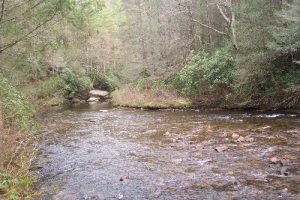
| Hike Summary: | Got to the Parking late. Left Burrells Ford Parking lot and hiked in for an embarrassingly short five minutes until we found a perfect spot by the river(N34'58.624, W083'06.657). Set up camp and hiked back to Spoon Auger Falls and took some photos. Made our way back to camp, set up fire, ate some Chili Mac, drank some spirits and fell asleep peacefully with the sound of the river. Got up around 7, made some hot soup and headed out around 8:30. Back in Atlanta in about 2.5 hrs. |


There are no comments yet.