DeSoto Falls - Member Hike
| Hike Name: | DeSoto Falls |
|---|---|
| Country: | United States |
| State: | Georgia |
| Nearby Town: | Cleveland |
| Rating: |  |
| Directions: | Hwy 19 North from Dahlonega for about 18 miles. (4.2 miles past Turner's Corner) to DeSoto Falls Recreation Area. |
| Total Hike Distance: | 3.00 miles |
| Hike Difficulty: | No Answer |
| Permit Required: | No |
| Hike Type: | In & Out, Backtrack Hike |
| Hike Starts/Ends: | Parking Lot |
| Trails Used: | In and out the middle falls trail and then in and out the lower falls trail |
| Backcountry Campsites: | No |
| Backcountry Water Sources: | Streams |
| Management: | National Park Service |
| Contact Information: | http://www.fs.fed.us/conf/desotocp.htm |
| Best Season: | Spring, Fall |
| Users: | Hikers, Dogs |
| Road Conditions: | Primary Paved Roads |
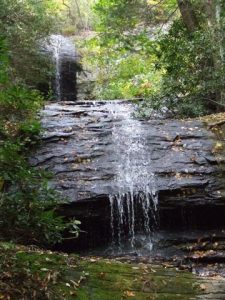
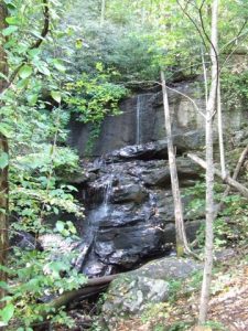
| Hike Summary: | There are two falls. The trail to the middle falls is a 2.5 mile trail unpaved trail. From the same starting point take the unpaved trail for .8 miles to the lower falls. At both falls there are observations decks for viewing and pictures. |
Recommended
Trip Reports
There are no Trip Reports yet.


There are no comments yet.