Brawley Mountain - Member Hike
| Hike Name: | Brawley Mountain |
|---|---|
| Country: | United States |
| State: | Georgia |
| Nearby Town: | Suches |
| Rating: |  |
| Directions: | Wilscot Gap from Blue Ridge, GA: Start from the intersection of the four-lane Appalachian Highway (U.S. 76, GA 2 and 515) and the Windy Ridge Connector (just east of Windy Ridge Road overpass and 0.8 mile east of McDonald's); follow the Appalachian Highway east for 3.3 miles to the junction of GA 60 (traffic light); turn right on 60 and go 0.3 mile to a stop sign; turn left (still on 60); go 1.5 miles to Morganton, GA; turn right with GA 60 in Morganton; proceed 7.4 miles to Wilscot Gap (Total Distance: 12.5 miles). A small parking area is to the left of the road. |
| Total Hike Distance: | 6.40 miles |
| Hike Difficulty: | Moderate to Difficult |
| Permit Required: | No |
| Hike Type: | In & Out, Backtrack Hike |
| Hike Starts/Ends: | Wilscot Gap |
| Trails Used: | Benton MacKaye Trail |
| Backcountry Campsites: | Yes |
| Backcountry Water Sources: | Springs |
| Management: | None |
| Contact Information: | Benton MacKaye Trail Association P.O. Box 6 Cherry Log, GA 30522 https://bmta.org/ |
| Best Season: | Winter, Spring, Fall |
| Users: | Hikers, Dogs |
| Road Conditions: | Primary Paved Roads, Secondary Paved Roads |
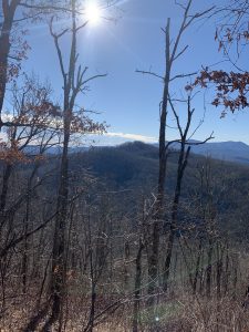
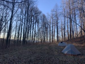
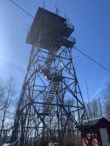
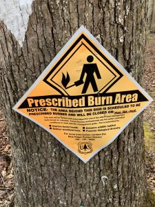
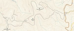
| Hike Summary: | Brawley Mountain (3027') is the site of a fire tower that is the only remaining one on the entire Benton MacKaye Trail. The tower is used for TV and radio communications and is no longer accessible to the public. At summit, there is a flat area with winter views of Blue Ridge Lake and the surrounding mountains. From Wilscot Gap, it is a 3.2 mile hike to Brawley Mountain. The hike begins with a steep 1.3 mile and ~700" climb up to Tipton Mountain (3147'), then descends and ascends multiple times to small gaps before you make the final 400' climb to Brawley Mountain. Camping is permitted at the summit, but there is no water here. The gated Forest Road 45 also leads from Wilscot Gap to the firetower - and you use it to loop back to the parking area if you want an alternative to the Benton MacKaye Trail on the return trip. |
Recommended
Trip Reports
There are no Trip Reports yet.



There are no comments yet.