Big Canoe - Upper Falls - Member Hike
| Hike Name: | Big Canoe - Upper Falls |
|---|---|
| Country: | United States |
| State: | Georgia |
| Nearby Town: | 0.8 |
| Rating: |  |
| Directions: | Directions Via GA 400 from Atlanta From I-285, take GA 400 to Hwy 369 exit. Turn left and go 12 miles to Yellow Creek Road. Turn right and follow to the end. Turn right, go 1/4 mile to Steve Tate Highway. Turn left and go 1.5 miles to the main entrance of Big Canoe. Once inside the gate proceed directly to Wolfscratch Village and Big Canoe Realty. There are two ways to reach the Upper Falls Trail (from within the property of Big Canoe): 1. Mountain Mint: Park at the end of Mountain Mint and follow the Jeep Trail to the access point for the Upper Falls. 2. From the Lower Falls Trail: Follow the Lower Falls Trail to the Lower Falls, you join the Upper Falls Trail across the road from the Lower Falls. |
| Total Hike Distance: | 0.80 miles |
| Hike Difficulty: | Easy to Moderate |
| Permit Required: | No |
| Hike Type: | In & Out, Backtrack Hike |
| Hike Starts/Ends: | Mountain Mint Trailhead |
| Trails Used: | Upper Falls Trail/Jeep Trail |
| Backcountry Campsites: | No |
| Backcountry Water Sources: | Streams |
| Management: | Private Property |
| Contact Information: | For information or assistance, call Big Canoe at 770-893-2733 or toll free at 1-866-BIGCANOE. |
| Best Season: | Winter, Spring, Summer, Fall |
| Users: | Hikers, Dogs |
| Road Conditions: | Primary Paved Roads, Secondary Paved Roads |
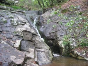
| Hike Summary: | This is a short hike in Big Canoe that descends 0.4 miles from the trailhead to a small and two-tiered waterfall known as Upper Falls. The hike follows an old jeep trail to the falls which carve a deep cut out of exposed rock. There are two small pools in the waterfall and picnic tables and even a trash receptacle at the base. The hike back out is entirely uphill but it's suitable for small children. |
Recommended
Trip Reports
There are no Trip Reports yet.


There are no comments yet.