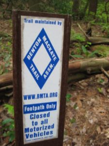
Benton McKaye trail section 2 - Member Hike
| Hike Name: | Benton McKaye trail section 2 |
|---|---|
| Country: | United States |
| State: | Georgia |
| Nearby Town: | Blue Ridge |
| Rating: |  |
| Directions: | Take 76 north past Blue Ridge., Georgia. Take highway 60 south to Morganton. Continue on highway 60 about 10 miles until you pass Skeenah Gap Road on the left. You will see a camping area at Skeenah Creek. The trail crossing is about 1 mile ahead. Forest Service road 816 is on the right. Ample parking space is provided on the side of road. |
| Total Hike Distance: | 11.60 miles |
| Hike Difficulty: | Difficult |
| Permit Required: | No |
| Hike Type: | In & Out, Backtrack Hike |
| Hike Starts/Ends: | Highway 60 |
| Trails Used: | Benton McKaye/Duncan Ridge |
| Backcountry Campsites: | Yes |
| Backcountry Water Sources: | Streams, Rivers |
| Management: | U.S. Forest Service |
| Contact Information: | Unknown |
| Best Season: | Winter |
| Users: | Hikers |
| Road Conditions: | Primary Paved Roads |
| Hike Summary: | This trip was intended as a test with a fully loaded pack. I carried an external pack frame weight of 35 pounds. The Benton McKaye Trail (BMT) heading south climbs steeply from highway 60 to the top of Tooni Mountain. I began my hike just after 8 am with the temperature in the mid 30's. I was glad I had on a wool vest, tobogan and mittens. I started out in dense fog but gradually climbed out of the fog as I gained elevation. The trail climbs 600 feet in the first mile. The view from the top was clear and sunny. The swinging bridge over the Toccoa River is 3.6 miles south from highway 60. I reached the river around 10 am and found no one in sight. I crossed the 260 foot suspension bridge and continued south. After a steep climb away from the river, I continued mostly uphill for 2 hours and reached Bryson Gap. I rested there for a few minutes before starting the return trip. An hour and 15 minutes later, I reached the bridge and found quite a few people. I climbed away from the river and ascended Tooni Mountain which was a tough climb. I continued over the mountain and ended my hike where it began at Highway 60 at 3:30 pm. The total trail time was about 8 hours. I was very glad to stop too. The muscles above my right shoulder were killing me and the muscle just below my right hip was causing considerable pain. I assume that I’m not adjusting the pack properly to keep the weight off my shoulders. I hope to correct this problem next time. |
Recommended
Trip Reports
There are no Trip Reports yet.


2 replies on “Benton McKaye trail section 2 - Member Hike”
Tooni Mountain in near Blue Ridge, Georgia. It’s part of section 2 of the Benton McKaye trail.
Tooni Mountain is no push over. I think this is Georgia though.