Yosemite National Park - Hetch Hetchy - Member Hike
| Hike Name: | Yosemite National Park - Hetch Hetchy |
|---|---|
| Country: | United States |
| State: | California |
| Nearby Town: | Mather, CA |
| Rating: |  |
| Directions: | From CA Hwy 120 one mile west of the Big Oak Flat entrance station to Yosemite National Park, take the Hetch Hetchy turnoff and follow Evergreen Road, then Hetch Hetchy Road 16 miles to the parking lot above Hetch Hetchy Reservoir and O'Shaughnessy Dam. |
| Total Hike Distance: | 19.20 miles |
| Hike Difficulty: | Moderate |
| Permit Required: | No |
| Hike Type: | Roundtrip, Loop Hike |
| Hike Starts/Ends: | O'Shaughnessy Dam |
| Trails Used: | North wall of Hetch Hetchy |
| Backcountry Campsites: | Yes |
| Backcountry Water Sources: | Streams, Lakes |
| Management: | National Park Service |
| Contact Information: | National Park Service Yosemite National Park, CA 95389 |
| Best Season: | Summer, Fall |
| Users: | Hikers, Horses |
| Road Conditions: | Primary Paved Roads, Secondary Paved Roads |
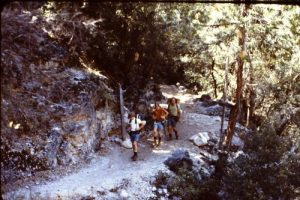
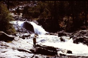
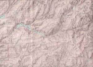
| Hike Summary: | Trailhead is the parking lot adjacent to O’Shaughnessy Dam. This dam -- yes, a dam inside a national park -- is famous in the world of conservationists. In the late 19th and early 20th centuries the concept of a national park was still new, and its purposes were as yet undefined. The Sierra Club, with John Muir at its head, proposed defining the national parks as places of minimal development where wilderness reigned supreme. Others disliked the idea of wilderness and proposed large scale development in the parks. The city of San Francisco, needing additional water sources to supply its growing population, looked to the national park as an inexpensive source and requested permission to build a dam and flood the Hetch Hetchy Valley with a reservoir to supply its water needs. After many years of battling in Congress, the Secretary of the Interior (the former city attorney for San Francisco) in the Woodrow Wilson administration gave executive approval to build the dam. That decision broke John Muir’s heart. He died shortly after losing that battle. The construction of the dam and subsequent flooding of the valley, galvanized conservation groups across the country, and in a very short time the National Park Service was created to protect the parks, and a national policy to restrict development within the national parks was formalized. Because of Hetch Hetchy, magnificent landmarks such as Grand Canyon, Kings Canyon and Glacier National Parks were spared having dams constructed within their boundaries. Hike across the dam, go through the tunnel, and follow the service road until it begins to switchback up the mountainside 1 mile from the dam. At that point, the hiking trail branches off to the right while the road turns to the left. For the next mile, the trail is easy, fairly level, with lots of shady areas. The trail will begin to climb before it reaches Wapama Falls. At the creek crossing below Wapama Falls, there are a couple of good bridges for hikers. Beyond the bridges, the trail alternates between open stretches and oak trees for the next mile as it begins an 800’ ascent up the shoulder of Hetch Hetchy Dome. Then for the next 1.25 miles it descends 600’ to a creek crossing (again, on a bridge) at Tiltill Creek. After crossing the creek, the trail switches back a couple of times during the 400’ (over 1.75 mi) ascent to Rancheria Falls. From Rancheria Falls, the trail goes through another series of switchbacks as it ascends 1300’ over the next 1.3 miles into a little pass. From there it drops down 400’ (over 1.7 mi) into Tiltill Valley. The next part of the trail is the most demanding of this hike. From the second creek crossing in Tiltill Valley, the trail immediately begins a long series of tight switchbacks as it climbs 2100’ (over 3.0 miles) over the south shoulder of Mt. Gibson. Most of this trail is in timber, but as it approaches the highpoint it gets into the alpine zone. From there, it descends 1100’ through the rockstrewn slope of the mountain for 1.7 mi to Lake Vernon. Lake Vernon is largely in an alpine meadow with very few trees nearby. From Lake Vernon, hike west up the slopes of Moraine Ridge. It’s a 500’ climb over 1.8 miles to the top of the ridge, and then the trail drops down 500’ over the next 0.8 mi to a trail junction a little over half a mile east of Laurel Lake. This valley is an open stand of timber, and the lake can be seen from several points along the trail. Stay on the main trail (unless you want to turn off to the right to camp at Laurel Lake). After another mile (with another 200’ drop), there will be a trail to the left that climbs 200’ and passes through a saddle. Turn left onto this trail and climb 1.2 miles through the saddle. From there you can see Hetch Hetchy and the dam below you. Follow the trail and then the service road it joins for 1.5 miles to the trailhead at the dam. |
Recommended
Trip Reports
| Date | Rating | Duration | Hiker | |
|---|---|---|---|---|
|
July 6, 1970 |  |
5 days | gmyersut |
|
June 20, 1970 |  |
5 days | gmyersut |


There are no comments yet.