South Ridge Trail to Tahquitz Peak - Member Hike
| Hike Name: | South Ridge Trail to Tahquitz Peak |
|---|---|
| Country: | United States |
| State: | California |
| Nearby Town: | Idyllwild |
| Rating: |  |
| Directions: | Head south on the 243 from Idyllwild, turn left on Saunders Meadow Road. Turn north onto Pine Avenue (you can only turn north) then turn right onto Tahquitz View Drive, follow it until you see a sign for South Ridge Road. It isn't really a sign for the road, but it lists the trail as an option on the sign. Turn right and follow it to it's completion. |
| Total Hike Distance: | 6.00 miles |
| Hike Difficulty: | Moderate |
| Permit Required: | Yes |
| Hike Type: | In & Out, Backtrack Hike |
| Hike Starts/Ends: | Idyllwild |
| Trails Used: | South Ridge Trail |
| Backcountry Campsites: | No |
| Backcountry Water Sources: | None |
| Management: | U.S. Forest Service |
| Contact Information: | Unknown |
| Best Season: | Spring, Fall |
| Users: | Hikers, Dogs |
| Road Conditions: | Unmaintained Gravel or Dirt Roads, Four Wheel Drive Recommended, High Clearance Vehicle Recommended |
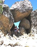
| Hike Summary: | You will need to get a hiking permit from the ranger station in Idyllwild for this hike. You do not need a day pass to park at the trail head. This is a moderately difficult trail through oak, chinnapquin, chapparal, and eventually a pine forest. You get lovely views all along the trail, and some of the boulders along the way are fascinating. At the top is a fire lookout manned by some friendly people from May-November. You can walk around it to see in every direction. On a clear day, the view is outstanding. The trail starts with some switchbacking, then flattens out for a bit, and for the last mile, the switchbacks are pretty steep and you are hiking in sand. Bring plenty of water if you are planning this hike, there are not a lot of trees to shade you in the last mile or so, so it gets very hot in the summer. |


There are no comments yet.