Moro Rock and Tunnel Log - Member Hike
| Hike Name: | Moro Rock and Tunnel Log |
|---|---|
| Country: | United States |
| State: | California |
| Nearby Town: | Fresno, California |
| Rating: |  |
| Directions: | Take CA-180 E out of Fresno for 52 miles to the Big Stump Entrance of Sequoia and Kings Canyon National Parks. After the entrance, turn righ on CA-198 W/Generals Highway. Drive 29 miles and turn left on Crescent Meadow Road. Drive another 1.3 miles and turn right onto the one-way loop. Follow the loop for approximately one half of a mile and park in the parking lot. |
| Total Hike Distance: | 0.50 miles |
| Hike Difficulty: | Easy |
| Permit Required: | No |
| Hike Type: | In & Out, Backtrack Hike |
| Hike Starts/Ends: | Parking Area |
| Trails Used: | Moro Rock Trail |
| Backcountry Campsites: | No |
| Backcountry Water Sources: | None |
| Management: | National Park Service |
| Contact Information: | Sequoia and Kings Canyon National Parks 47050 Generals Highway Three Rivers, CA 93271-9700 Phone: 559-565-3341 Fax: 559-565-3730 http://www.nps.gov/seki/index.htm |
| Best Season: | Spring, Summer, Fall |
| Users: | Hikers |
| Road Conditions: | Secondary Paved Roads |
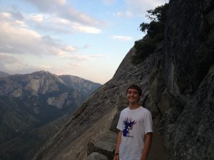
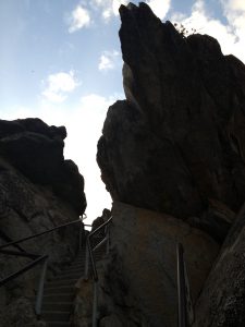
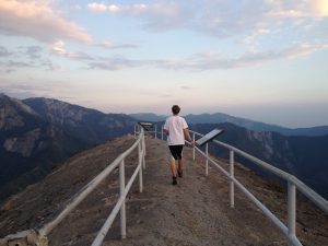
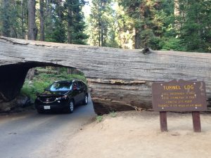
| Hike Summary: | Moro Rock is a granite dome in Sequoia National Park that offers great views of the High Sierra peaks that form the Great Western Divide. The hike consists of over 350 steps up a steep 1/4-mile (1/2-mile roundtrip) staircase to the summit. With a 300-foot gain, the top sits at an elevation of 6,725 feet. Although not part of the hike, the Tunnel Log is worth mentioning due to its proximity to Moro Rock. The Tunnel Log was formed when an unnamed giant sequoia fell across the Crescent Meadow Road in late 1937. The following summer, a tunnel was cut through the fallen log as a visitor attraction. When it fell, the tree stood 275 feet high and was 21 feet in diameter at the base. Apparently, the tree's age when it fell has not been determined, but probably exceeded 2,000 years. The tunnel, which remains in use today, is 17 feet wide and 8 feet high. |




There are no comments yet.