Mishe Mokwa Trail - Sandstone Peak - Member Hike
| Hike Name: | Mishe Mokwa Trail - Sandstone Peak |
|---|---|
| Country: | United States |
| State: | California |
| Nearby Town: | Oxnard |
| Rating: |  |
| Directions: | The trailhead is 1 mile east of the Circle X Ranch, which is located 5 ½ miles from Pacific Coast Highway on Yerba Buena Road in Malibu. Alternately, from Westlake Village, exit on Westlake Blvd from the 101 Freeway, and follow it south for several miles as it merges with Mulholland highway. Turn right onto Little Sycamore Canyon and it will become Yerba Buena Road as you cross the county line. Proceed on Yerba Buena Road for about 4 miles to trailhead. |
| Total Hike Distance: | 6.00 miles |
| Hike Difficulty: | Moderate to Difficult |
| Permit Required: | No |
| Hike Type: | Roundtrip, Loop Hike |
| Hike Starts/Ends: | Mishe Mokwa Trail |
| Trails Used: | Mishe Mokwa Trail |
| Backcountry Campsites: | No |
| Backcountry Water Sources: | Streams |
| Management: | None |
| Contact Information: | Unknown |
| Best Season: | Winter, Fall |
| Users: | Hikers |
| Road Conditions: | Primary Paved Roads |
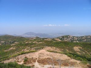
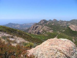
| Hike Summary: | This is a pretty easy hike, on a nice cool day. When the temperature is above 90 degrees, it can be a little difficult. We are not 100% sure, but it had to be 100 degrees when we were there. There is some rocky points and some parts of the trail with water damage, but over-all the trail is in great condition. The Mishe Mokwa trail is a 5 mile hike at a gradual incline. There are quite a few shady spots which helped in the heat. At the one mile mark, you come across Split Rock. This provides a nice flat, shaded area with a picnic table for a quick break. The rock is pretty facinating and is fun to climb. Awesome, breathtaking views await at the top. Sandstone Peak is the highest point in the Santa Monica Mountains and has a wonderful view. |


There are no comments yet.