Millard Canyon to Dawn mine - Member Hike
| Hike Name: | Millard Canyon to Dawn mine |
|---|---|
| Country: | United States |
| State: | California |
| Nearby Town: | Altadena |
| Rating: |  |
| Directions: | From 134 FWY Exit Lake ave. in Pasadena. Go North until Lake turns to left to Loma Alta Drive. Follow Loma Alta About 1/2 Mile to Chaney Trail Drive. Turn Right (N). Follow Chaney trail to the junction just before Millard Campground. Park Outdside locked fire road gate. -National Forest Adventure Pass Required- |
| Total Hike Distance: | 5.00 miles |
| Hike Difficulty: | Moderate to Difficult |
| Permit Required: | No |
| Hike Type: | In & Out, Backtrack Hike |
| Hike Starts/Ends: | Sunset Ridge/Mt'Lowe fire road |
| Trails Used: | Sunset fire road, unmarked trail, cross-country along stream |
| Backcountry Campsites: | No |
| Backcountry Water Sources: | Streams |
| Management: | U.S. Forest Service |
| Contact Information: | Angeles National Forest 701 N. Santa Anita Avenue Arcadia, CA 91006 626-574-1613 www.r5.fs.fed.us/angeles |
| Best Season: | Winter, Spring, Summer, Fall |
| Users: | Hikers |
| Road Conditions: | Primary Paved Roads, Secondary Paved Roads |
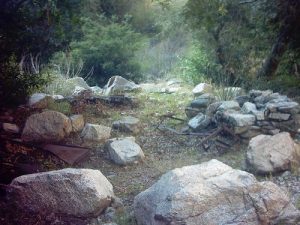
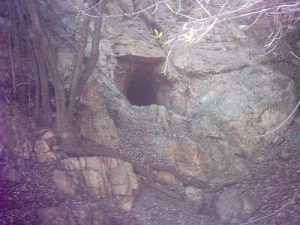
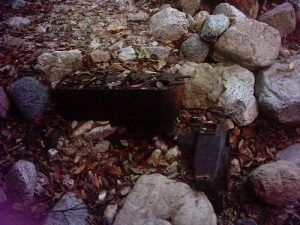
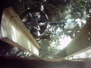
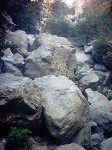
| Hike Summary: | Copy/Paste Coming #19 in John W. Robinson's "Trails of The Angeles" This Hike involves a lot of boulder hopping. The remnants of an old trail still run along the canyon walls but, are sparse and unmaintained. Though not too extraordinarily difficult, it is not a quick in and out hike. Because of the scrambling involved, dogs would probably have too hard a time with this one. Some of the highlights of this hike are the various "artifacts" left from the old mining operations. The old trash left behind by miners can be found everywhere. Mostly pipes are found, some very old (riveted formed sheet metal), some more modern. I do not know too much of the history of this operation but, my curiosity warrants a little fact finding. I will add whatever info I find. In Trails of the Angeles Robison mentions that small amounts of gold were extracted during intermittent operations dating from 1895 to the early 1950's. This is an interesting link regarding dawn mine and Millard Canyon. http://www.aaaim.com/echo/v2n3/index.htm From Chaney trail drive follow the sunset ridge/Mt. Lowe fire road about 400 yards and pick up the trail on the left. Follow the trail to the junction with the Sunset trail (on right). Go left over a small bridge passing a private cabin. The trail drops down to the stream bed and soon disappears. Follow the stream around the bend and continue past a concrete dam. There are sections of trail, and logs placed to help you cross the stream. Continue this way for about a mile. Just after a Northward turn of the canyon you reach a mass of boulders about 50’ high. An easy path lies to the right. Climb carefully. After this point the graffiti and trash all but disappear. Don’t be to surprised to have the canyon to yourself (except in summertime). About 1/8 mile from the boulder dam, there is an old miner’s haunt in a clearing on your left. The hang out is circled with large rocks. The remains of an old bench and mining cart can be seen as well as a mortared fireplace. This is a good place to have lunch. From here continue your scramble upstream picking up short sections of trail here and there. Some sections are degraded and treacherous. I recommend following the streambed unless you encounter a particularly rough section. About ¾ mile from the boulder dam is Dawn mine. A shallow shaft will be visible to your left just ahead of the actual mine. Various bits of machinery and piping are scattered about. Just ahead you will see an old pump on a concrete slab jutting out of the wall. To the left is the mine, partially obscured by a boulder. Going inside is not recommended (unless you are experienced in such things). Apparently there are large water filled holes inside. Not fun to go for a dip in such a dark place. You can look around here for a while, look around upstream or take the Dawn Mine trail up to the Mt. Lowe railway for a much longer loop, or turn back here. The trail sections are easier on the return for some reason. An alternative trailhead for this hike begins in the lower canyon from Millard Campground. Folow Millard canyon to the falls. Several yards before the falls you'll see a white pole on the right. You can scale the steep, loose section to the top of the falls and above to upper Millard canyon, combining two of the listed hikes. This approach can be a little dangerous and is best not tried if you have any doubts. |


One reply on “Millard Canyon to Dawn mine - Member Hike”
very well. Winter time brought high water to the creek trail so you had to remember how to get there. If you have been there let me know at 971-998-6336 or email me at charlieclark@cherokeelaser.com. I plan on going again before I die, I hope, cause I am 74 now. Best, Charlie