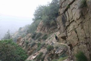
Millard Canyon - Dawn Mine - Member Hike
| Hike Name: | Millard Canyon - Dawn Mine |
|---|---|
| Country: | United States |
| State: | California |
| Nearby Town: | Altadena |
| Rating: |  |
| Directions: | From the 210 Fwy take the Lake Ave exit and head north on N Lake Ave for 3.6 miles. N Lake Ave turns left and becomes E Loma Alta Dr Travel 1.0 mi on E Loma Alta Dr and turn right at Chaney Trail. Trail up Chaney Trail for 1.1 mi to a parking area (Adventure Pass Required). |
| Total Hike Distance: | 6.00 miles |
| Hike Difficulty: | Easy to Moderate |
| Permit Required: | No |
| Hike Type: | Roundtrip, Loop Hike |
| Hike Starts/Ends: | parking area |
| Trails Used: | Sunset Ridge fire road, Sunset Ridge Trail, |
| Backcountry Campsites: | No |
| Backcountry Water Sources: | Streams |
| Management: | U.S. Forest Service |
| Contact Information: | Unknown |
| Best Season: | Winter, Spring, Summer, Fall |
| Users: | Hikers, Bikers, Dogs |
| Road Conditions: | Secondary Paved Roads |
| Hike Summary: | From the parking area (N34º12’53.3”W118º8’51.9”) head East on the Sunset Ridge Fire Road (aka Mt Lowe Rd). Go about 400 yards (0.23 mi) down the road (PAST the Millard Campground Trail) and take the Sunset Ridge Trail on your left (N side of trail). About 0.9-1.0 mi you fill find a trail branch, take the steeper trail to the right (S side of trail). You will bump into the Sunset Ridge Fire Road again, but just walk a short distance and again head onto to a trail on your left (N side of trail). At 2.4-2.5 mi you will once again return on to the Sunset Ridge Fire Road. Head North along the road for about ½ mile and continue on the Dawn Mine Trail on your left (NW side of trail) (total so far: 2.9 miles). Travel down the sometimes loose footing trail until you reach the stream. There you will find the Dawn Mine after only 3.5-3.6 miles. It may be difficult to see the mine since there is a big rock in front of the entrance. Return Trip: Head down along the stream. The trail will appear and disappear along the stream, but just stick with it and enjoy the fabulous views. After some distance you will come to a waterfall (sheer drop-off), the trail is there, but hard to see. The trail is on the East side of the stream, continue following the stream trail down until you reach a campground area (Millard Campground Parking area is further downstream). Walk SE along the campground access road (approx. ¼ mile) until you find a trail leading upslope. Take this trail up the slope and it will lead you back to trail branch you encountered at the beginning of the hike. This means you have less than 1 mile to enjoy the rest of this lush canyon foliage on this hike. Word of caution: There is an abundance of Poison Ivy along portions of this trail so be prepared if you are allergic. |


There are no comments yet.